In pursuit of moths and owls in Oman’s Hajar Mountains
Published:
In late 2024 my friend Frederic approached me and asked if I wanted to join him hiking John Edwards’ route for the traverse of the Hajar Mountains in the Sultanate of Oman (more details on that route here). Trusting Frederic’s good taste in adventure and having long wanted to visit Oman, I leapt at the opportunity.
The Hajar Mountains
The Hajar mountains are a 700 km long range of mountains and hills in the north of Oman and the UAE. The highest part of this range is in Oman around the Jebel Akhdar massif, where it reaches its highest point, 3009 m, at Jebel Shams.
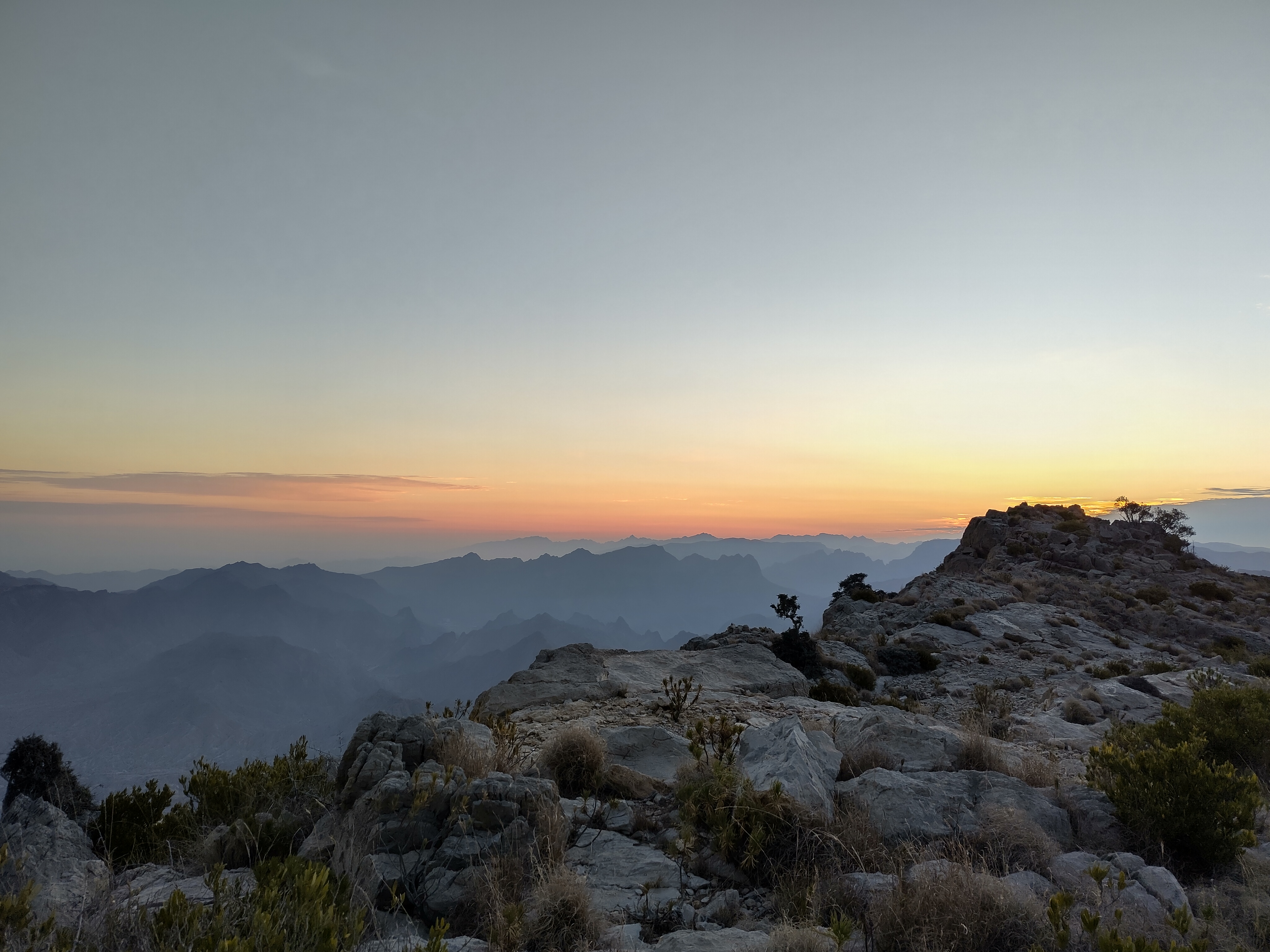 View of the Hajar mountains at dawn, looking east from our camp on the flanks of Jebel Shams at approx 2600 m.
Due to their altitude and proximity to the coast the Jebel Akhdar mountains are much more verdant than the rest of northern Oman (Jebel Akhdar meaning literally ‘green mountain’), and in some places support a unique open woodland habitat dominated by Dodonaea, Olea, and the beautiful Pashtun Juniper Juniperus seravschanica.
Due to their remoteness little is known about the insect fauna in these mountains (for a survey see Monks et al.), but the birdlife is distinctly south-central asian in flavour, with Persian wheatear Oenanthe chrysopygia, Plain leaf warbler Phylloscopus neglectus, and Ménétries’s warbler Curruca mystacea all being common wintering species. The Jebel Akhdar range is perhaps best-known for being the premier site to see Omani owl Strix butleri. However, most birders only visit two well-known and car-accessible wadis searching for this species. As far as I could tell from my research, no-one had looked for this bird higher up in the Hajar before, so I was excited to see if I could add new sites for this species. Additionally, using my newly-purchased LepiLED, I was eager to see what moths lurked in the Hajar.
The Route
The route for a 200 km traverse of the Jebel Akhdar range was first published in 2019 by John Edwards (hereafter referred to as John), using ancient man- and donkey-tracks for passage of man and beast between the mountain villages. While the mountains are arid, the traverse is made possible by a network of water sources along the route. Most of these are Aflaj — remarkable water channels draining from mountain acquifers, channelling water into shaded storage pools and into fields. Others are more primal, and may simply be a large bucket positioned underneath a cave drip, holding water for thirsty travellers.
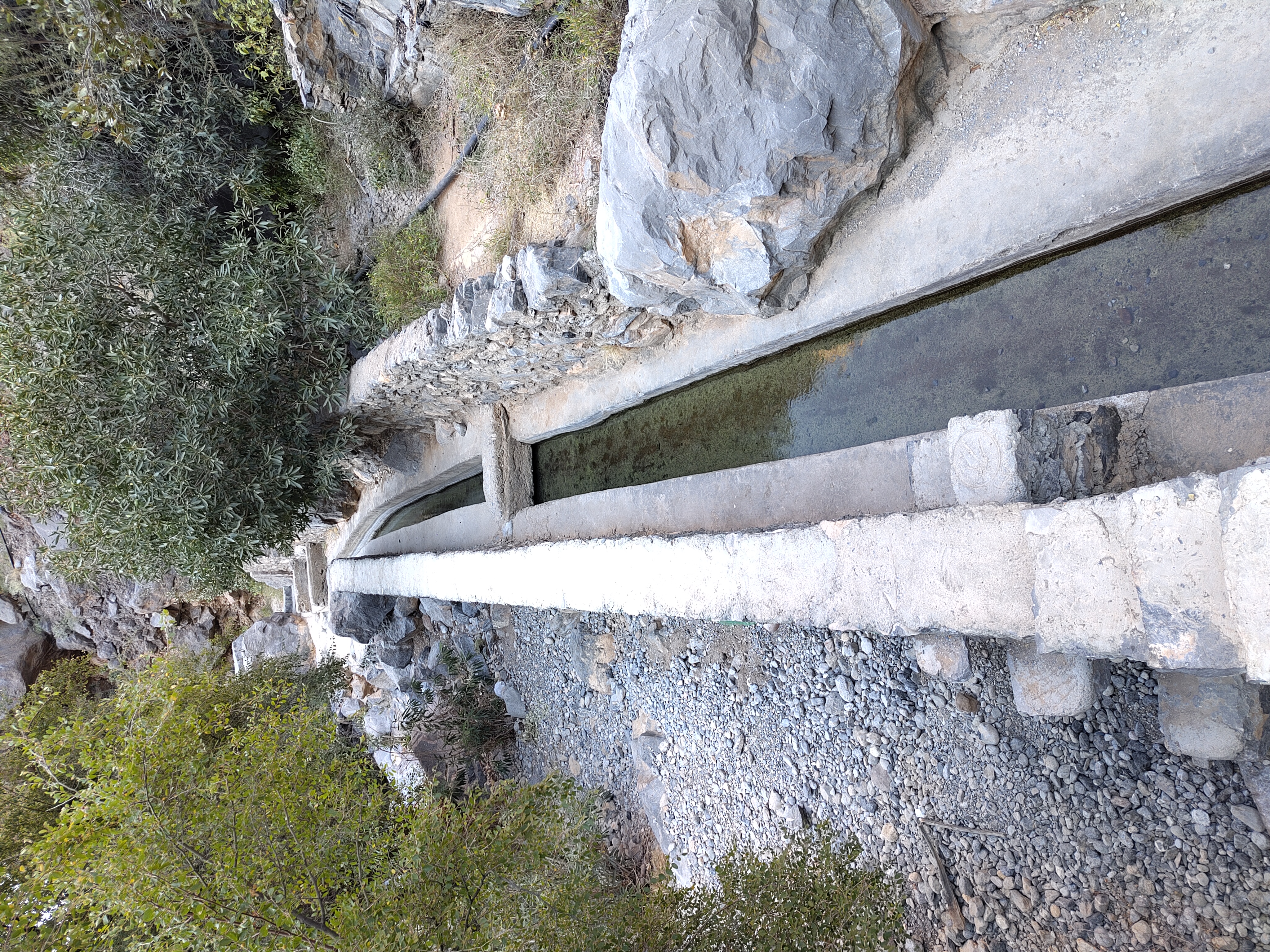 The Aflaj in Misfah al Abriyyn. Not shown are the shoals of Killifish that made this tiny channel their home.
The traverse takes about two weeks and John recommends undertaking the walk in February, to maximise daylight hours while minimising rainfall and excessive heat. Not wanting to contradict John’s sage advice, a trip was arranged for February 2025 between Frederic, myself, and Frederic’s friend Lukas.
Days 1 & 2 - Muscat to Hadash via Al Afyah
It was mid-morning on the 6th of February when we assembled together in Muscat airport. Happy to see Frederic again and pleased to meet Lukas, we immediately sought a taxi to take us to our starting point, in the village of Al Afyah, just west off the Muscat-Nizwa highway. Having struggled a bit with directions (my Google Maps app, at least, defaults to rendering arabic names in the saudi dialect, and so was unintelligible to our omani driver), we arrived at the start point at approx 1300 and begun filling our water bottles in the aflaj.
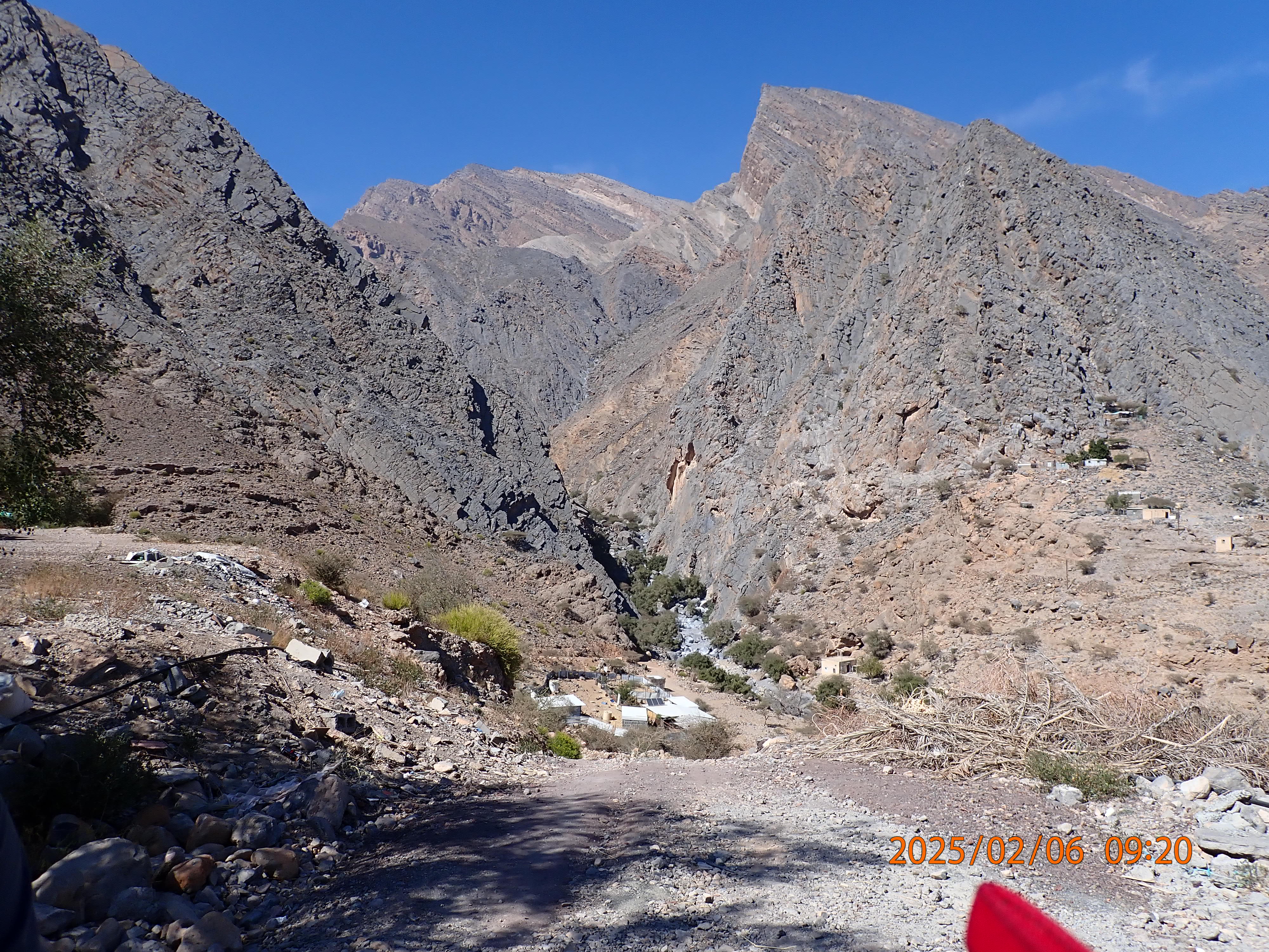 The starting point of our Hajar adventure, the wadi entrance at Al Afyah (approx 700 m).
Starting so late in the day we planned to break the first leg of our journey over two days, camping somewhere up near the top of our 1400 m ascent to the ridge where we then descend 600 m to the village of Hadash in the spectacular Al Ghubrah bowl. There is no water source along this path, so we had to be prepared for two days without resupply.
Here is where I made a dangerous mistake that affected everyone for the next three days. Having already drunk a lot of water, and already having a very heavy rucksack (25kg+), I only filled up my bottles with three litres of water - one litre for our ascent this afternoon, then two litres for cooking and the final climb and descent into Hadash. This proved absolutely moronic.
The track from the wadi up the mountain was challenging with such a large pack but very beautiful. Birdlife included Pale Crag Martin Ptyonoprogne obsoleta, Desert Lark Ammomanes deserti, and Arabian Green Bee-eater Merops cyanophrys, as well as a Long-billed Pipit Anthus similis, which I was very pleased to see.
However my poor state of fitness, the 30°C heat, weight of my pack, and total lack of sleep on the plane began to compound into fatigue, and after a couple of hours I was badly lagging behind the fit and nimble Frederic and Lukas. As night began to fall we were far short of where we wanted to be and had to camp amongst a steep boulder field.
Despite our poor position this was a very beautiful camp, and once the sun set we were bathed in bright moonlight. I am amazed by how bright the moon is in Arabia. While wearing a headtorch was still prudent to avoid falls, in moonlight it was largely unnecessary. Once darkness fell a Pallid Scops owl Otus brucei started its ‘hoo!-hoo!-hoo!-‘ call from somewhere down in the wadi.
The next day was a truly beautiful dawn and we were awoken by the raucous calls of Grey francolin Ortygornis pondicerianus and the more pleasant song of the Sand partridge Ammoperdix heyi — the latter species a real boost to morale as it was a species I had wanted to see.
However morale was soon deflated upon checking my water supply. In the heat of yesterday, and being ill-disciplined, I had drunk most of my three litres of water and had a mere 500 mL left for our long climb and descent into Hadash. With hindsight I’m not sure whether rationing water or drinking it as I had the day before would have been the better option. I was sweating horrendously in the walk up to camp the day before and had reasoned that water was probably better use in my body than on my pack in such circumstances.
Frederic and Lukas recognised the seriousness of the situation too, and to prevent us having to spend another night without a water source, they very kindly offered to take some of my luggage with them for this part of the journey, so as to make sure we all got to Hadash that evening. This helped a lot and by about midday we arrived at the base of the final scramble over the ridge to Hadash. By now I had drunk all my water and Frederic and Lukas were kindly sharing their responsibly rationed supplies with me.
However a brief boost to morale was afforded by us reaching a shaded plateau at the base of this scramble, with long flowing chest-height grass. The habitat was amazing and can best be described as some sort of Olea woodland-savannah. This would have made for a perfect camp site, as evidenced by a recently used firepit and small shelters constructed by overnighting goatherds. Alas we had to leave this place and carry on over the mountain to Hadash.
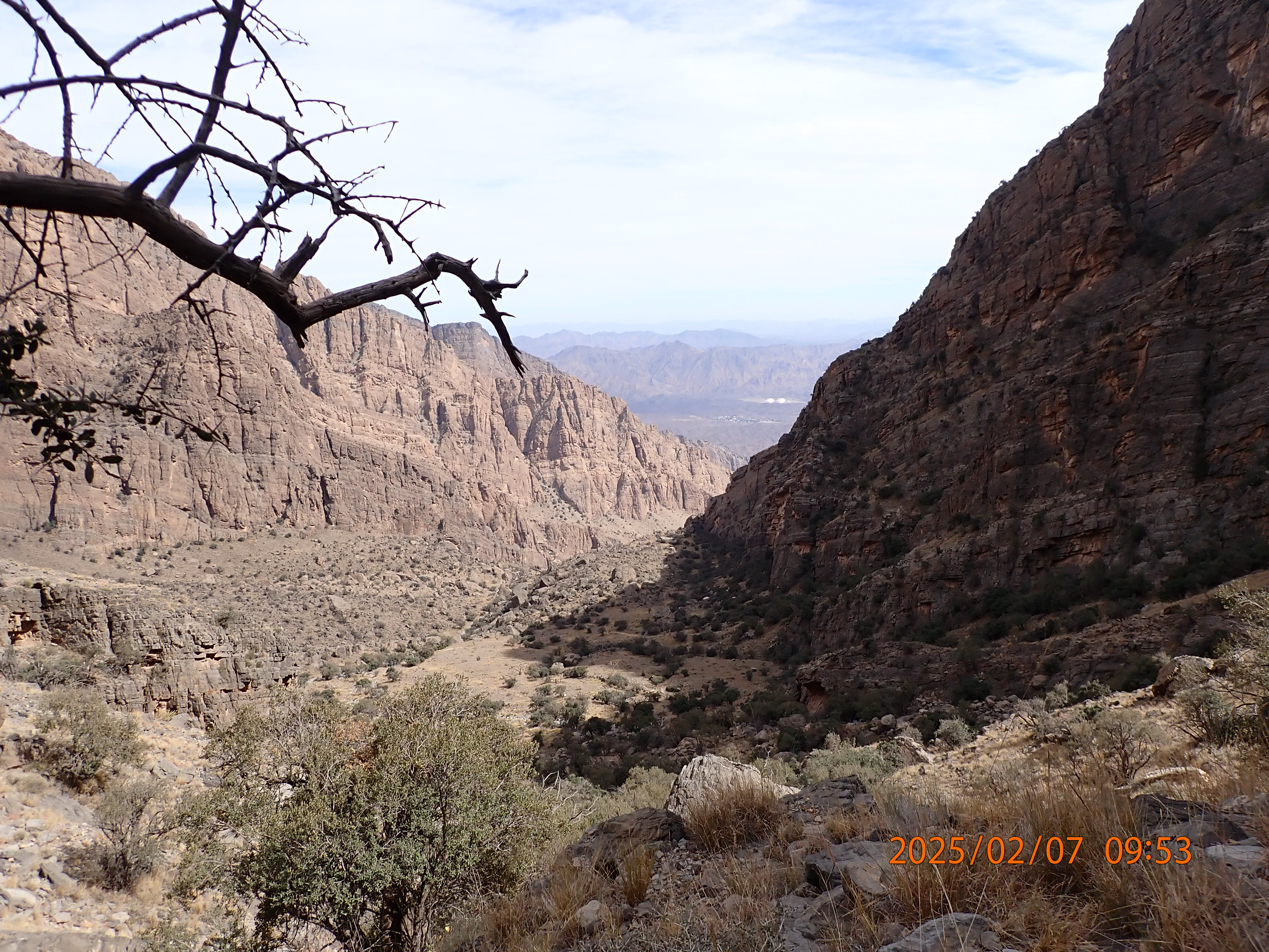 View looking east from approximately halfway up the final scramble (approx 2000 m). The small savannah plateau can be seen below.
The scramble up was tough but by about 1400 we had reached the top of the col and were now looking into the immense Al Ghubrah bowl, one of the best views I’d seen in a long time. On the scramble up, we were joined by Black redstarts Phoenicurus ochruros, Hume’s wheatears Oenanthe albonigra, and at the very top of the scramble, rewarded by a close and slow fly-by of a Bonnelli’s eagle Aquila fasciata cruising along the ridgeline.
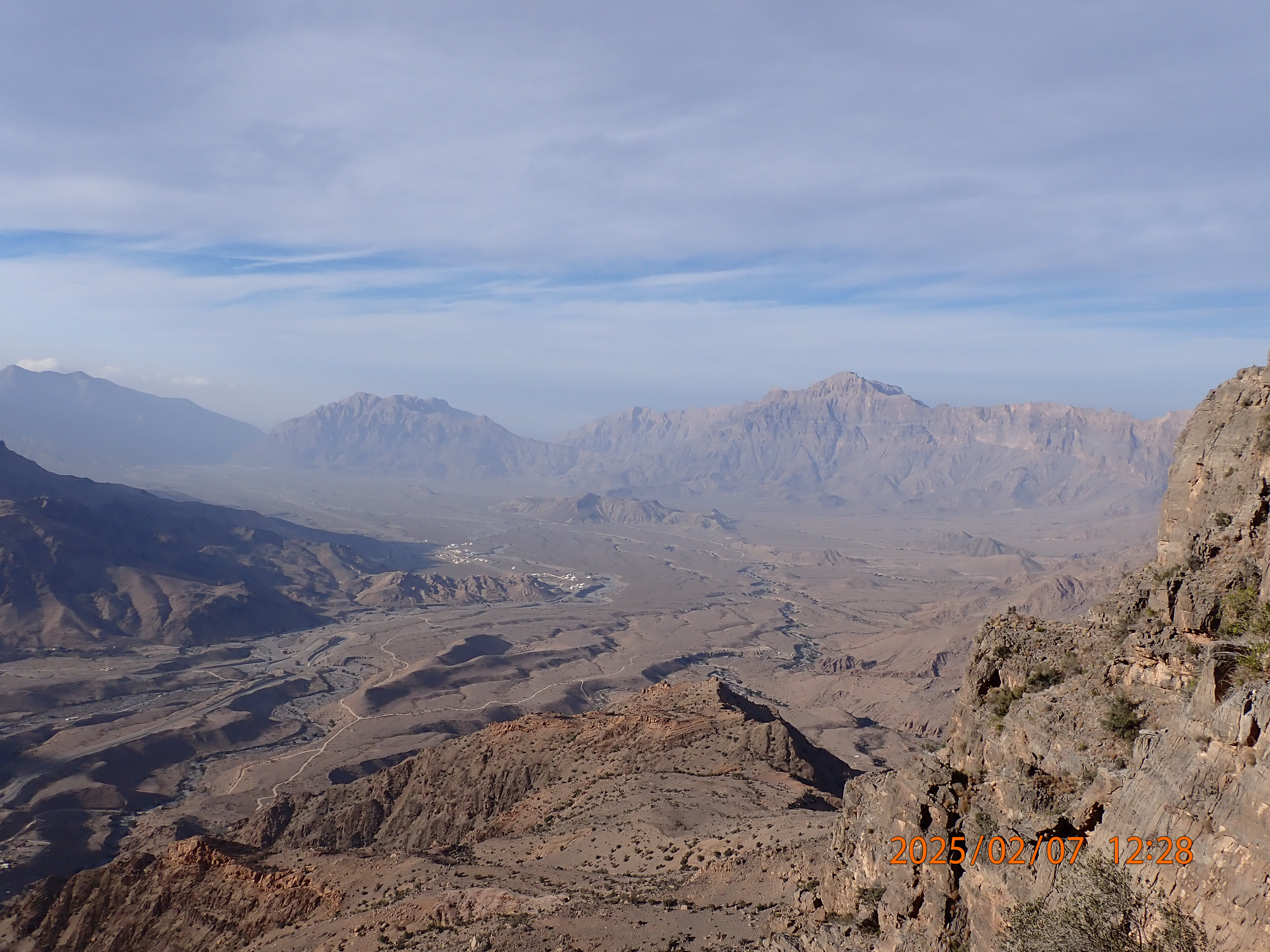 View looking north west from the top of the ridge into Al Ghubrah bowl. Omani owl country.
Now began our descent into Al Ghubrah to Hadash. This is where I first realised that John is the real deal. In his book he describes the route as having ‘some exposure’, which having done the route I would describe as a bit of an understatement. The descent is spectacular and takes you about 2 km along a cliff face, using a series of ledges and gullies. The path is well-marked and well-worn but for much of it there is nothing but air to your side, and a 30+ m drop in places onto the rocks below.
Sadly we had run out of water by the time we reached the col and we didn’t have time to savour this spectacular route or the views, with only three hours left before sunset. Thirsty we pressed on, and came off the cliff onto the slopes above Hadash — looking deliciously green — just as the sun dipped behind the mountains. Headtorches on, we traipsed for about 40 mins through more open Olea woodland down to Hadash. At Hadash there is a car park for tourists and above it, a flat area of gravel perfect for camping. We hastily dumped our packs there and filled up from the village’s Aflaj, bookending a very adventurous start to the trip.
I have to say this is one of the most fun routes I’ve ever done, and would love to do it again, but not with a large trekking rucksack full of a week’s worth of food! The large pack makes some of the moves on the descent difficult where the path does under an overhang and the pack forces you out towards the precipice, which can be a bit daunting.
We went back to camp and ate in the dark, then hastily made our beds and went to sleep. The cliffs around Hadash look perfect Omani owl habitat, but I was too tired to conduct any kind of survey. I slipped quickly into sleep.
Days 3-8 - Hadash to Misfah al Abriyyn, via Wukan, Muscat, and Nizwa.
We were woken at dawn by the call to prayer from the Hadash mosque. Still shaded by the large cliffs to our east, the morning was pleasantly cool. The birds of Hadash were making the most of the cool air and all around us we could hear the songs of Grey francolin and Sand partridge. At breakfast I also managed to spot a Scrub warbler Scotocerca inquieta skulking around at the base of a bush.
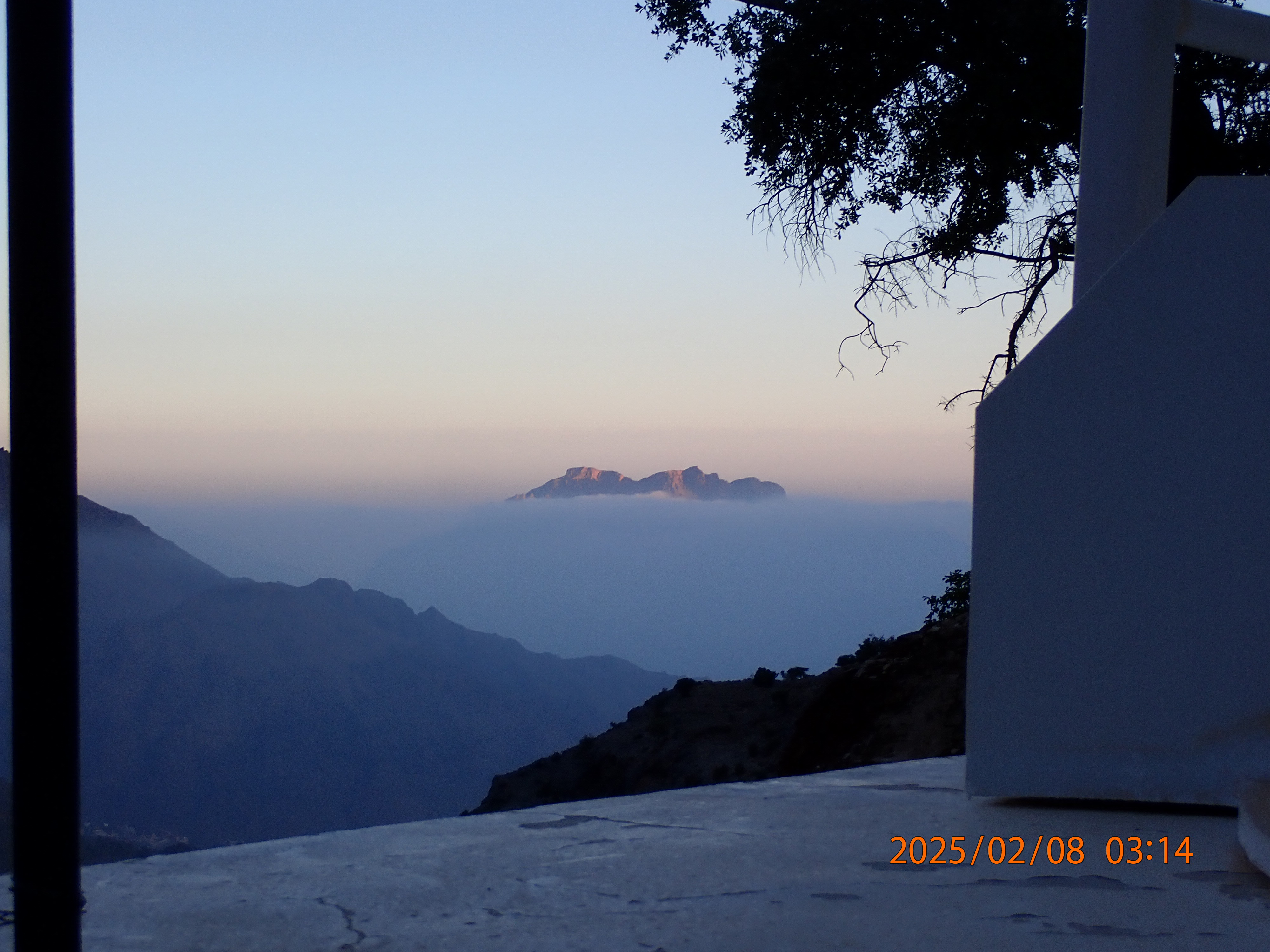 View looking across Al Ghubrah bowl at dawn, hidden by clouds.
The view at breakfast was pretty spectacular with our camp at 1500m sitting above the blanket of cloud covering the Al Ghubrah bowl. However once the sun showed his face over the ridge this quickly burned off and we knew we had to get underway.
After our ordeal the previous day we opted for an easier route, walking the road connecting Hadash to the village of Wukan, the next campsite on John’s route. The road proved not too birdy but some close views of Hume’s wheatear as we were leaving Hadash were much appreciated. After hitching a ride on the back of a beat-up Toyota Hilux and a bit of thirsty walking in the heat, we arrived at Wukan by the mid-afternoon.
Here I made the painful decision to temporarily part ways with Frederic and Lukas, who I was again lagging behind and would only slow down. We agreed to rendezvous at the village of Misfah al Abriyyn in five days’ time, the next point on the route which would be easily accessible by taxi.
Over that afternoon and the following day I explored Wukan, a very scenic agrarian village which held my first Purple sunbirds Cinnyris asiaticus and Delicate prinias Prinia lepida. There was also a large roaming flock of Chiffchaffs Phylloscopus collybita which I searched several times for a Plain leaf warbler Phylloscopus neglectus, but sadly they proved to all be collybita. At the top of the village a lone Pied Wheatear Oenanthe pleschanka was a welcome contrast to the ubiquitous Hume’s wheatears. Like Hadash the village is surrounded by steep cliffs which, covered in gnarled Olea, seemed like a perfect place to harbour Omani owl. Taking advantage of my long stay in the area I spent a couple of hours both nights listening for the owl at the top of the village beneath the cliffs, but heard nothing and left empty-handed.
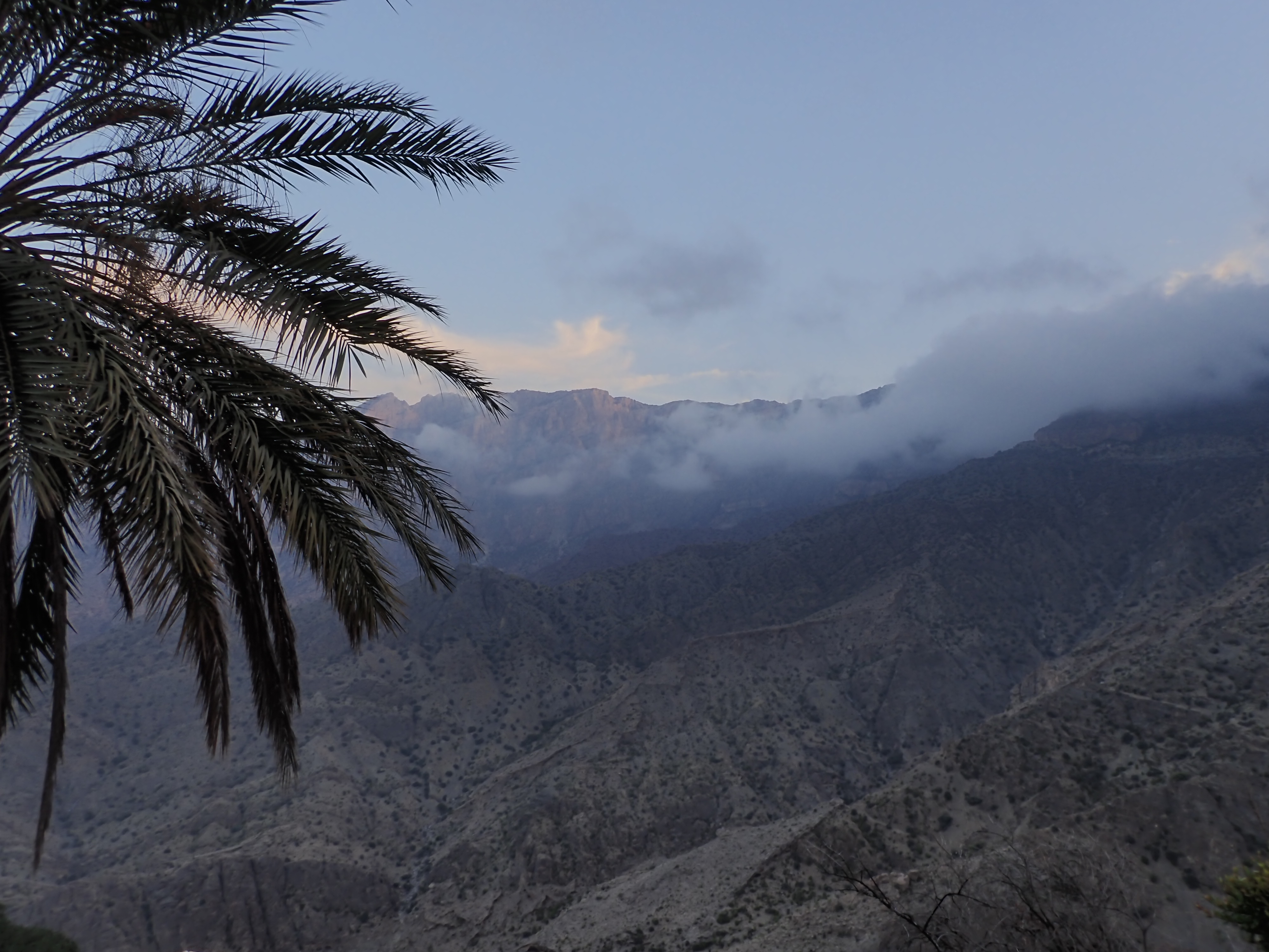 Listening for Omani owls at Wukan, looking east towards Hadash, and the scramble on day 2 (the far ridge).
The issue with not following John’s route is I now had to take a massive detour to link up with Frederic and Lukas again at Misfah. This route would have to take me first to Muscat, then along the Muscat-Nizwa highway (past the starting point of our hike) to Nizwa and on from there to Misfah somehow. Luckily I managed to hitch a lift with a kind young Finnish couple from Wukan back to Muscat. After an evening’s birding the mangrove estuary near Al Qurum beach, and a couple of hours in a taxi, I arrived in Nizwa.
From Nizwa my plan was clear: hire a car and look for Omani owl. One of the two car-accessible wadis visited by birders in pursuit of Omani owl is near Nizwa. I won’t reveal the specific wadi, but it’s easy enough to find if you know where to look online. After arranging a 24 hr rental with one of the Nizwa hire car companies, I was off in pursuit of owls.
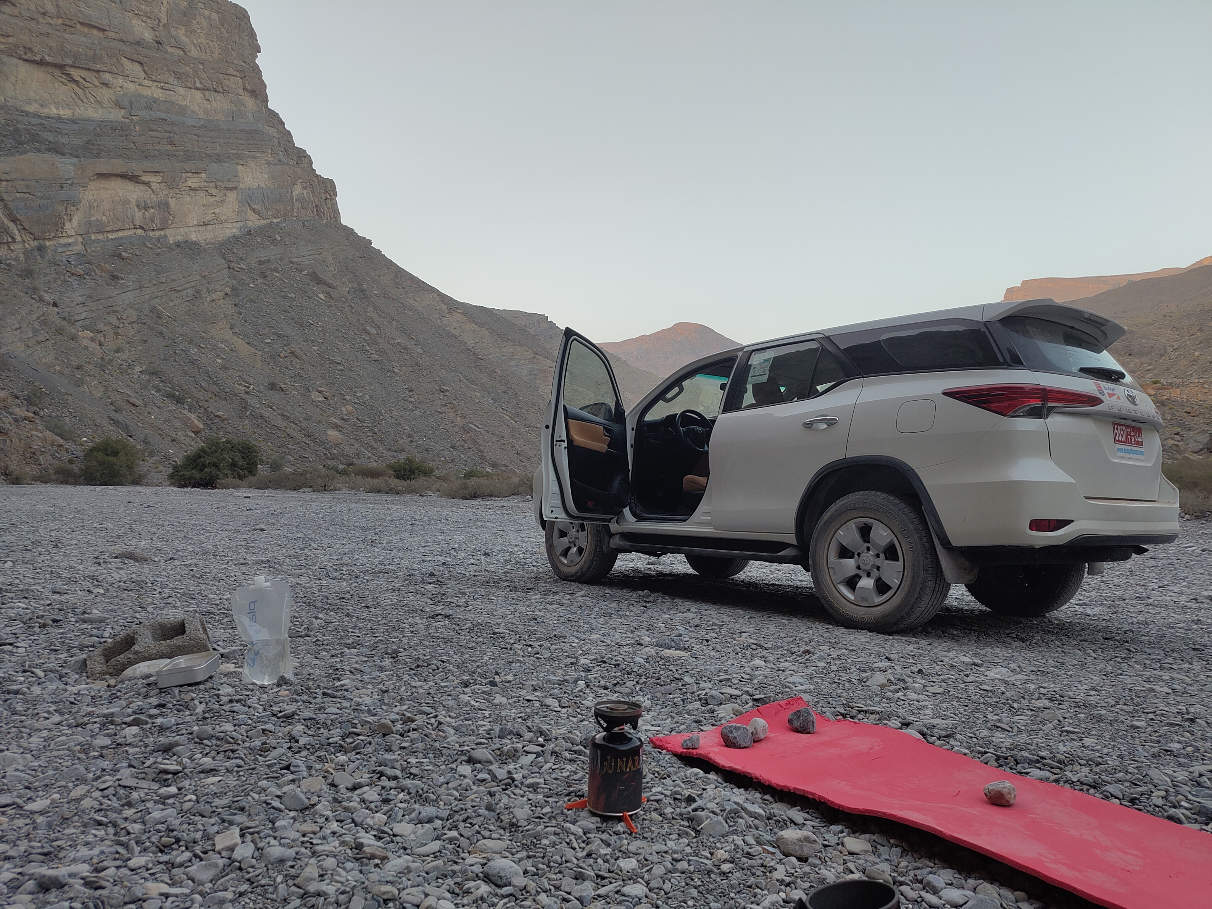 Car camping in the Omani owl wadi.
The plan was simply to camp out in the wadi, explore a bit in the dark, and listen for the birds. From what I could tell the owls should be active at dusk and dawn, so no need to lose too much sleep looking for them. I parked up next to the most-visited spot for the owls, and waited. As dusk fell I was optimistic, with a Pallid scops owl opening up song right next to camp as soon as the sun sank behind the ridge. However around 30 mins later strong winds blew up out of the desert, deafening me and likely causing any owls to hunker down in shelter. The wind went on til around 2300, and no further owls were heard. I passed out in car seat some time around 0100, and woke again as light was creeping into the wadi.
Like many of my mornings in Oman, the view upon opening my eyes was beautiful. The light in the wadis during the early mornings and late evenings really brings out the colours in the rock, and the air is pleasingly cool. A drive deeper into the wadi revealed it to be quite birdy, with plenty of passerines skulking amongst Acacia at the base of the cliffs. These included Lesser whitethroats Curruca curruca and Menetrie’s warblers Curruca mystacea, as well as Striolated bunting Emberiza striolata and Hume’s wheatear higher up the cliffs. Overhead three Brown-necked ravens Corvus ruficollis croaked.
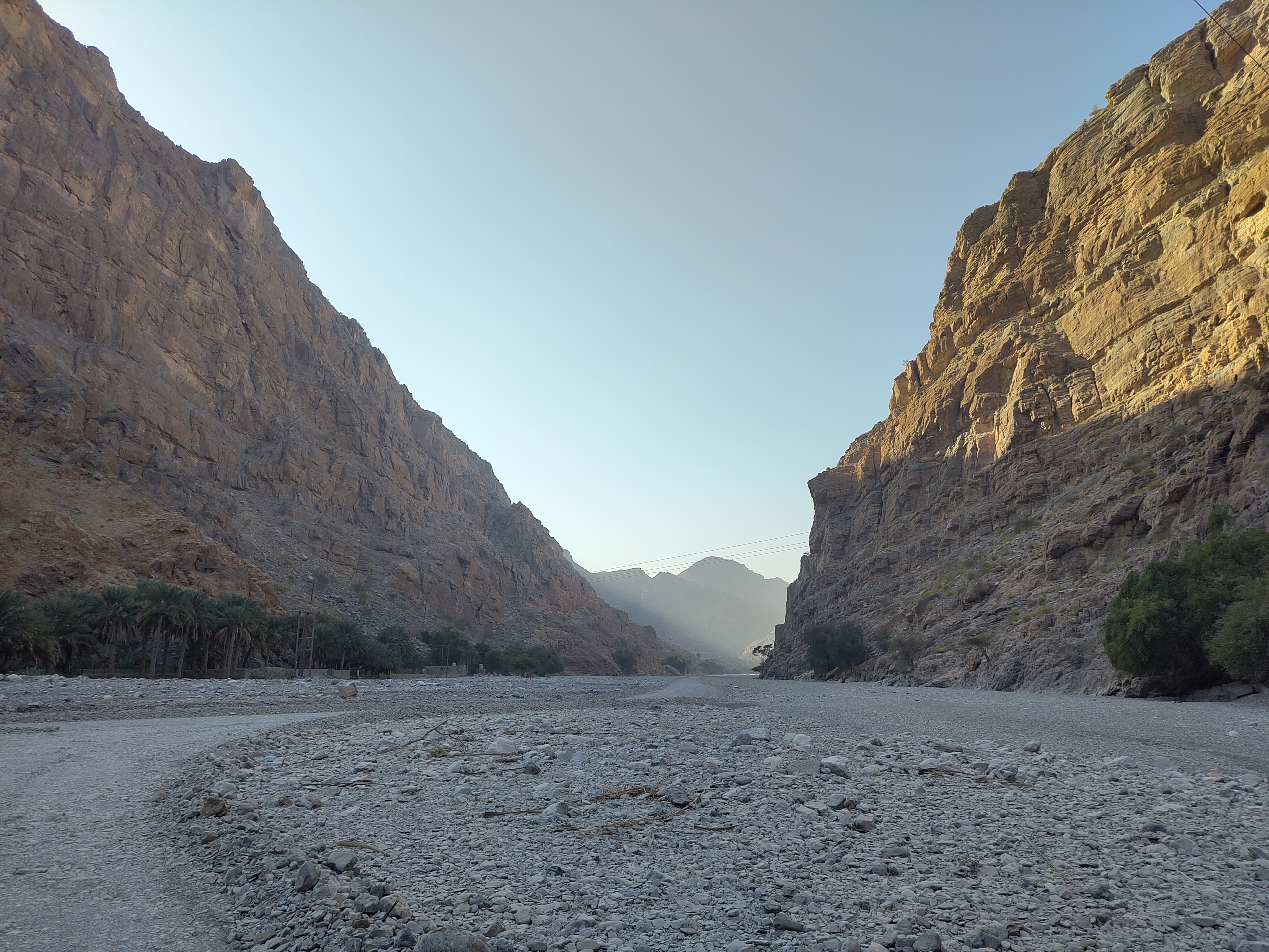 Morning light in the wadi.
Having drawn a blank on Omani owl, it was time to hand the car back and make my way to Misfah. At the very least I’d got my eye in for the owl’s habitat and would be on the lookout for similarly massive cliffs elsewhere in the Hajar. After an hour’s ride in a taxi I stepped out onto the tarmac carpark in front of Misfah village.
Misfah is popular with tourists, and rightly so. The mud and stone houses in the old village, at one time fallen into disrepair, have been recently restored and the village now supports three guesthouses. Also, unlike many places in Oman, you can hear the sound of running water, and walk under the shade of trees. The aflaj flows through the village and irrigates the village’s tiered fields planted with Date palms, Banana trees, and other crops unfamiliar to me.
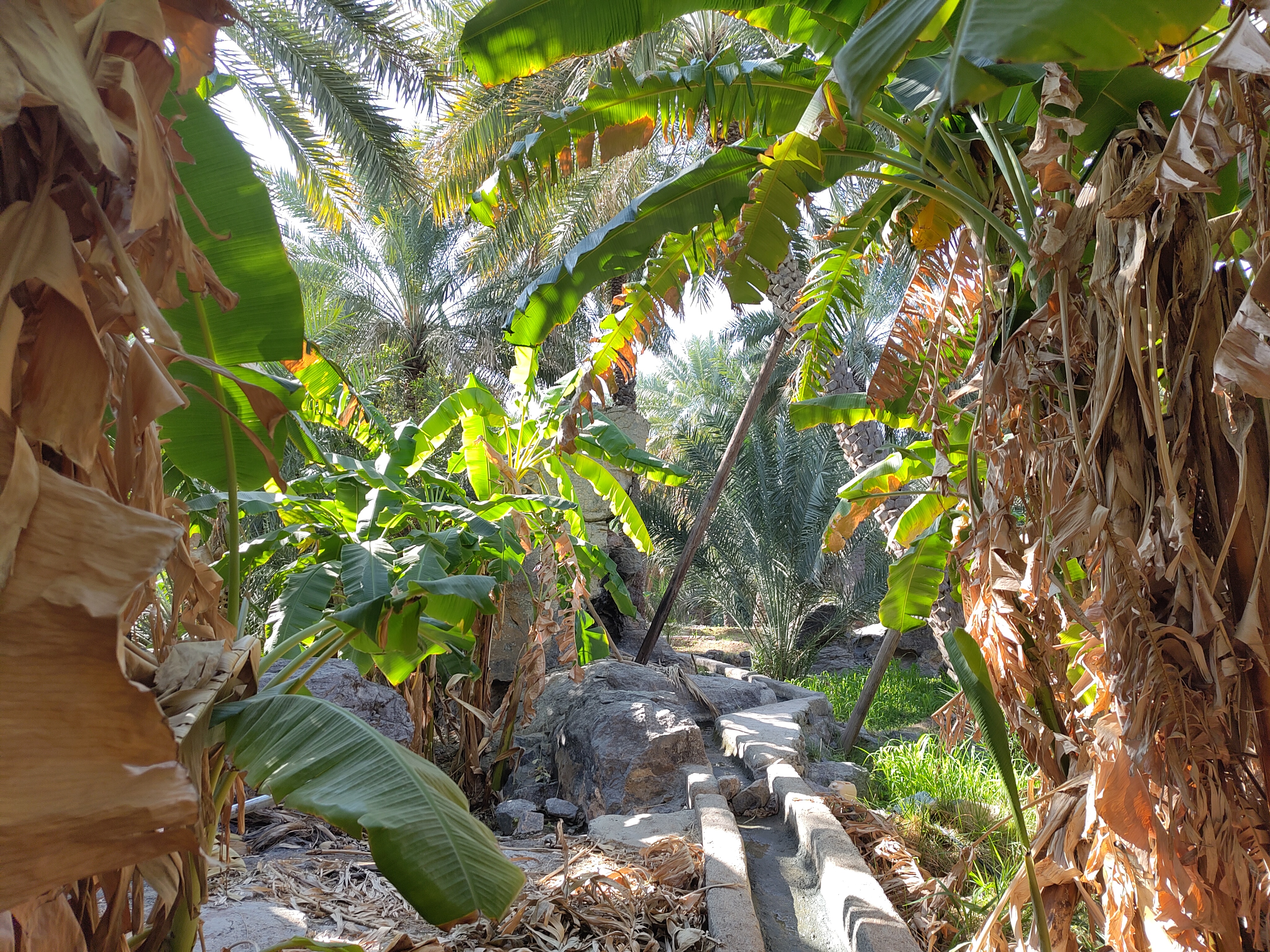 Bananas and Dates growing next to the Aflaj in Misfah al Abriyyn.
Misfah is an important part of John’s traverse of the Hajar. While staying the night in Misfah (a mere 900 m above sea level) is a considerable loss in elevation for walkers coming off the ~2000 m ridge above, it is possible to have post delivered to the guesthouses, thus making resupply of food and other essentials possible. Frederic had posted a parcel full of food ahead for us and the proprietor of our guesthouse was generous enough to collect it from the village post office, and hang onto it until we arrived.
After exploring the village a bit I walked up along the valley behind the village, which I expected Lukas and Frederic to come down on their descent into Misfah. At the head of the village overlooking the source of the Aflaj there is a ruined watchtower, and thinking there was no better place to watch for foreign intruders into Misfah, I sat and waited for the others. As it turned out I had only to wait fifteen minutes before I saw two familiar figures, dusty from the mountain, descending through the valley.
As our stay in the guesthouse was not til the following evening, we made camp that night in the dried riverbed at the bottom of the valley. Here I actually started to look for moths, and as night fell we picked a site to hang the LepiLED. We settled on a large smooth rock near our camp, with a convenient branch above to suspend the lamp.
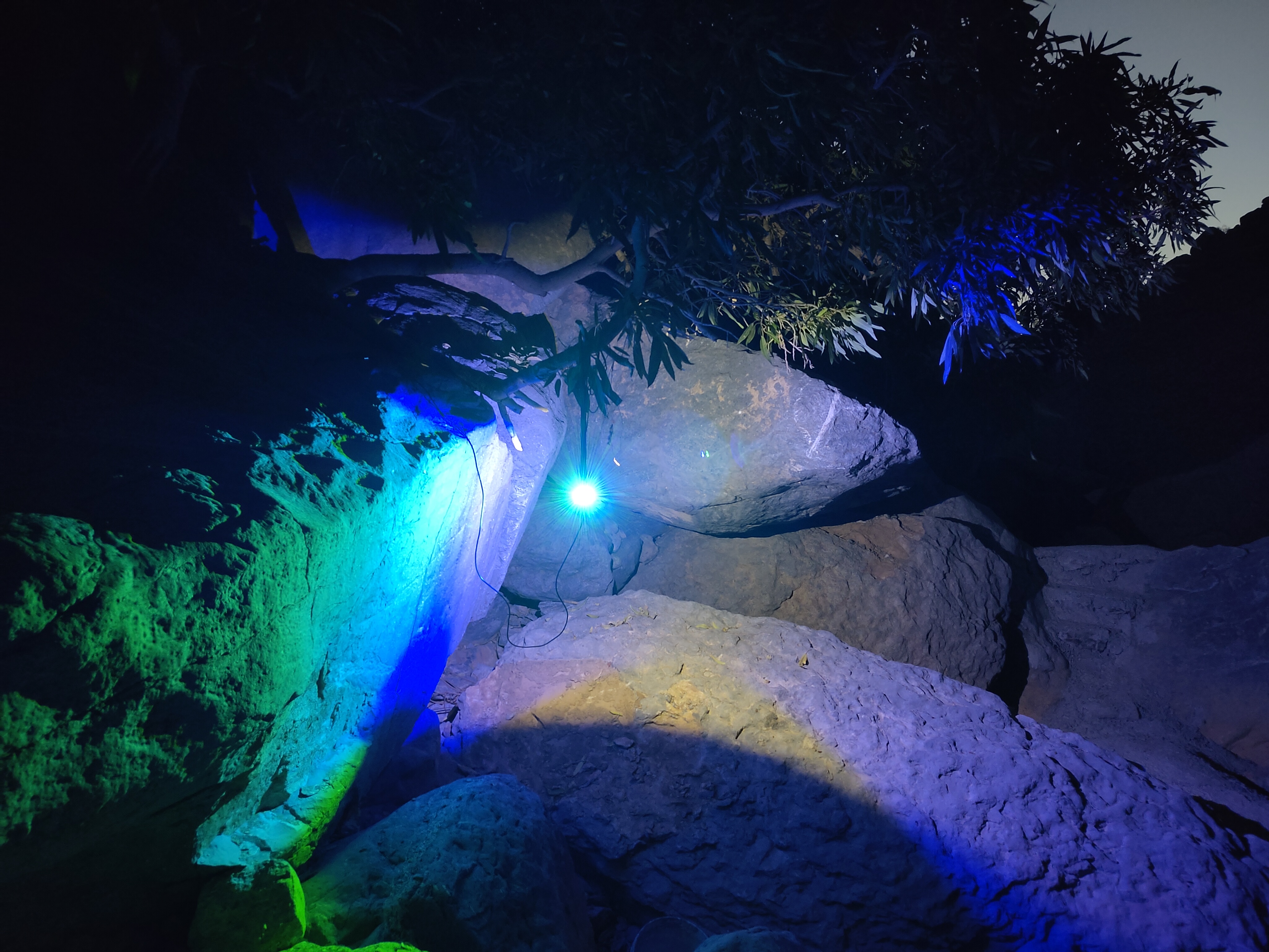 LepiLED in action outside Misfah al Abriyyn.
Pretty quickly after lighting up moths started to arrive. I was pleased to find that I could assign most of them a family, and some of them a probable genus, based on species I’m familiar with from the UK. One I was also able to identify straight away, Chiasmia latimarginaria, having seen images of this species in a Facebook post about moth trapping on Jebel Akhdar. Another fairly straightforward ID was of Eublemma alexi, the genus being immediately obvious and the species being nice and distinctive.
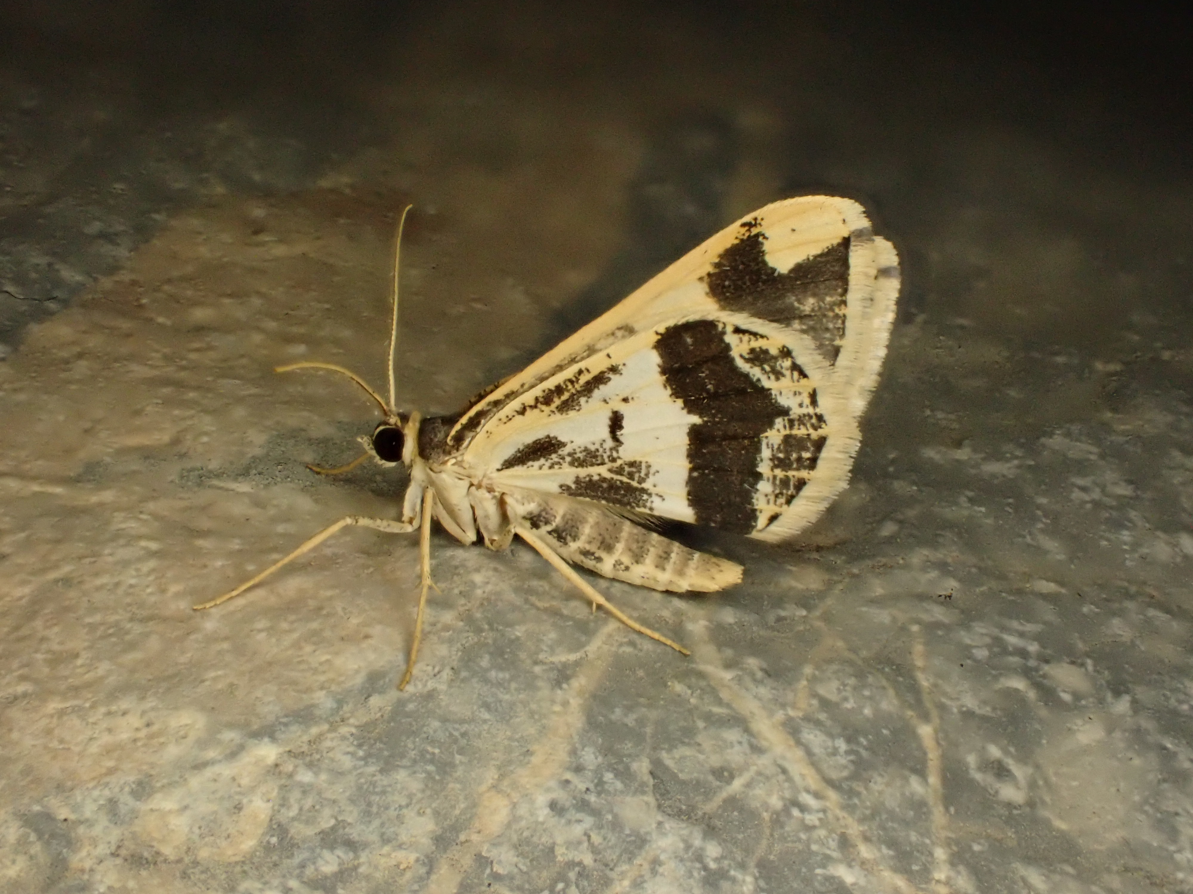 Chiasmia latimarginaria.
 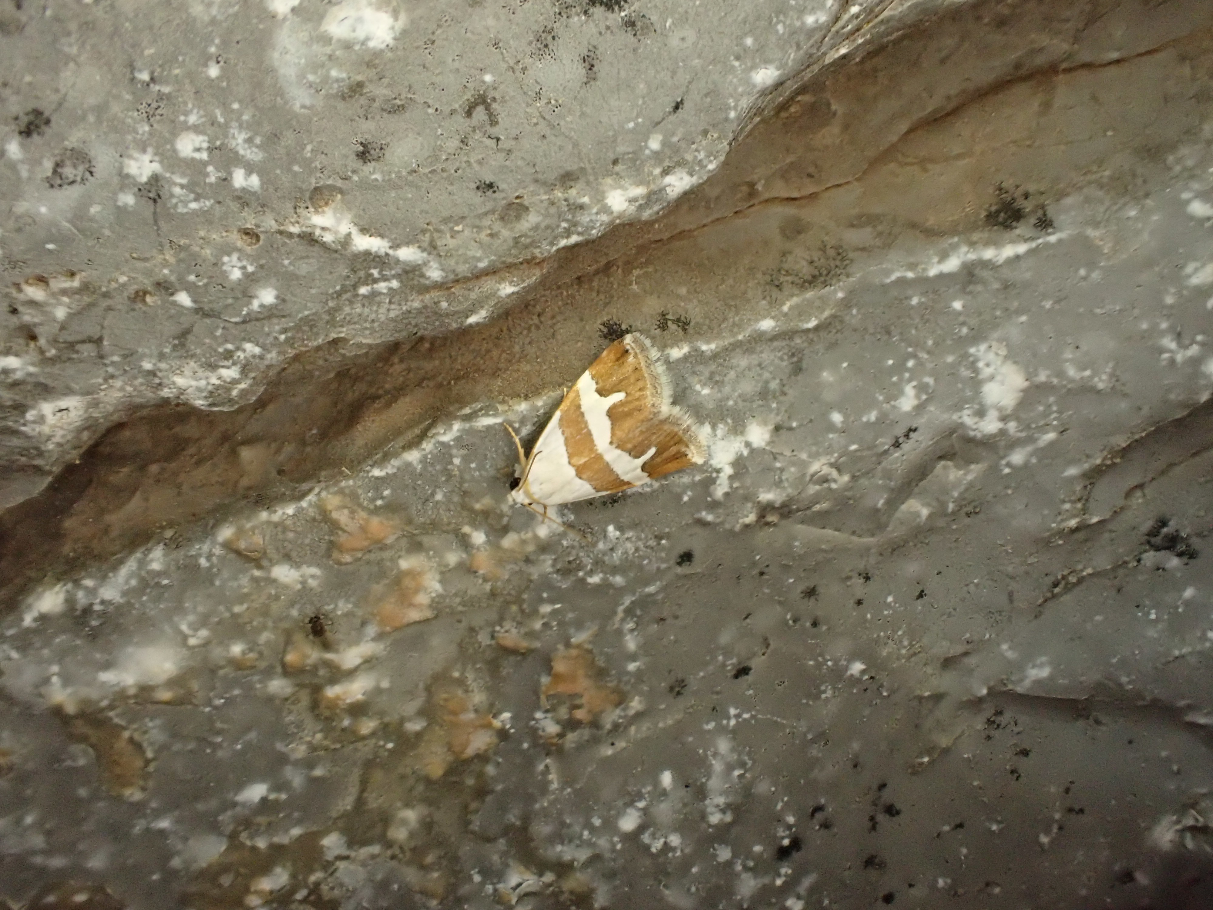 Eublemma alexi.
By far the stand-out moth for me though was a gorgeous blue and yellow Stathmopoda. Afromoths.net lists several very similar species in this genus, so I suspect the identity of this moth will have to remain unknown without dissection.
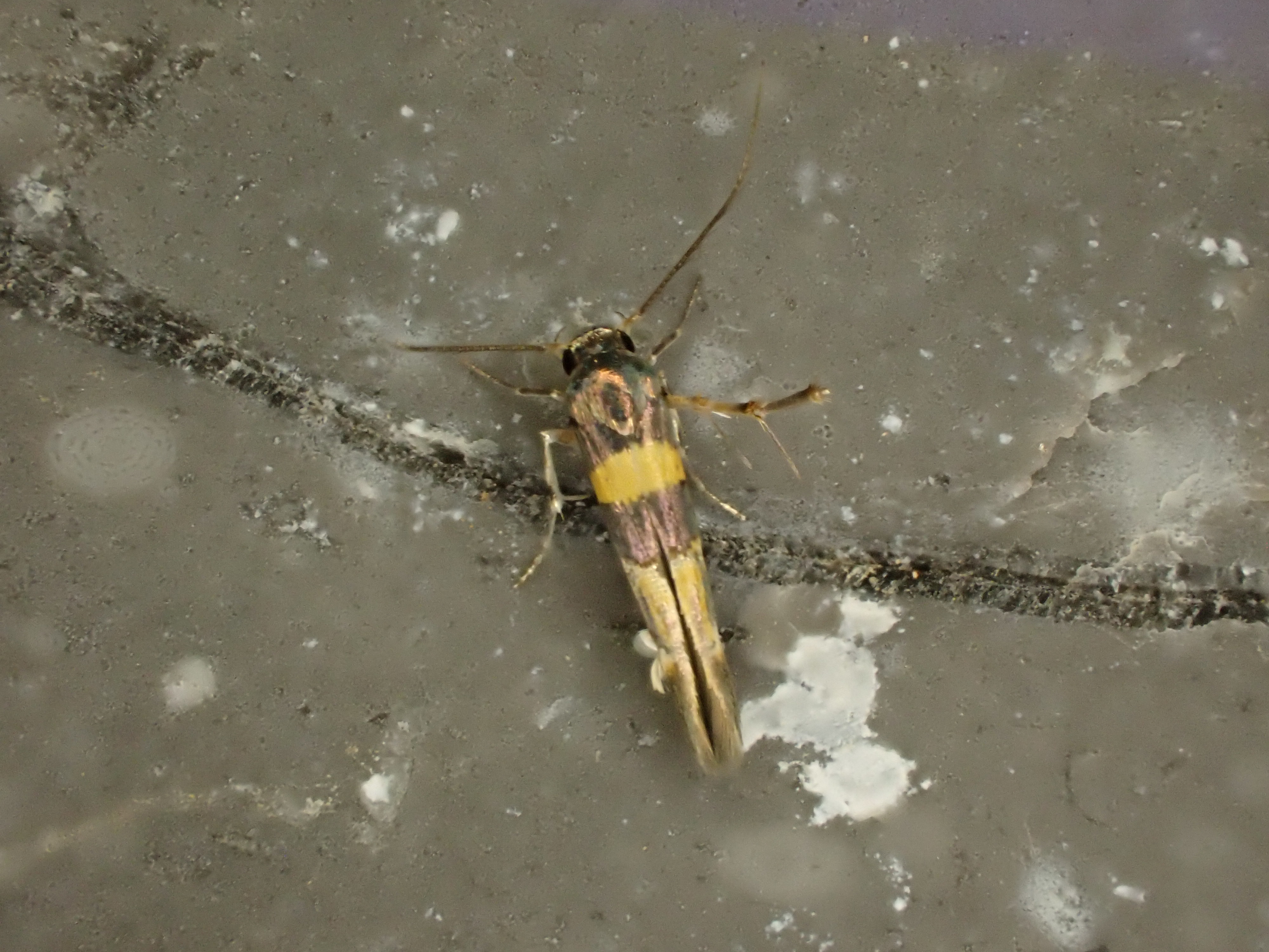 Stathmopoda sp.
After a couple of hours’ mothing we turned off the LepiLED and wriggled into our sleeping bags. Having spent the previous nights either in a car or a guesthouse it felt good to be sleeping under a bright starlit sky again. As I looked up I could see the silhouettes of bats nectaring in the trees above me. When the moon came over the ridge a Little Owl Athene noctua started its mewing call.
Days 9-13 - Misfah al Abriyyn to Jebel Shams, and back again
The following day was spent relaxing in Misfah and enjoying the greenery. Lukas was eager to take some time off the trail and see the cultural sights of Oman, so over the next few days it would just be Frederic and I walking. With this in mind we planned a circular route that would take us back up onto the ridge from which Frederic and Lukas had just descended, along west to Jebel Shams, then back down a long valley to Misfah, where we would rendezvous with Lukas again.
As we were only going to be gone for three days, we opted to leave surplus food and belongings in Misfah. Fortunately the owner of our guesthouse was extremely accommodating and happy to let us leave it with him. The hospitality in Misfah is really top-notch and the kindness shown by the owner of our guesthouse made a lot of what we did possible. The owner warned us about the ‘crocodiles and tigers’ on the mountain, and waved us off.
The walk up to the ridge was a gentle ‘donkey track’, still in active use by donkey caravans. This made the trail easy to find, either by the stream of donkey droppings amongst boulder fields or the smooth path worn by generations of hooves across bare limestone. Though we started early, the temperature was initially quite warm and unpleasant for walking. However by the time we reached the summit of the ridge at approx 1800 m it had dropped to a pleasant ~18°C. As we climbed the vegetation changed too, and it was near the top of the ridge that we first started to see Pashtun junipers J. seravschanica.
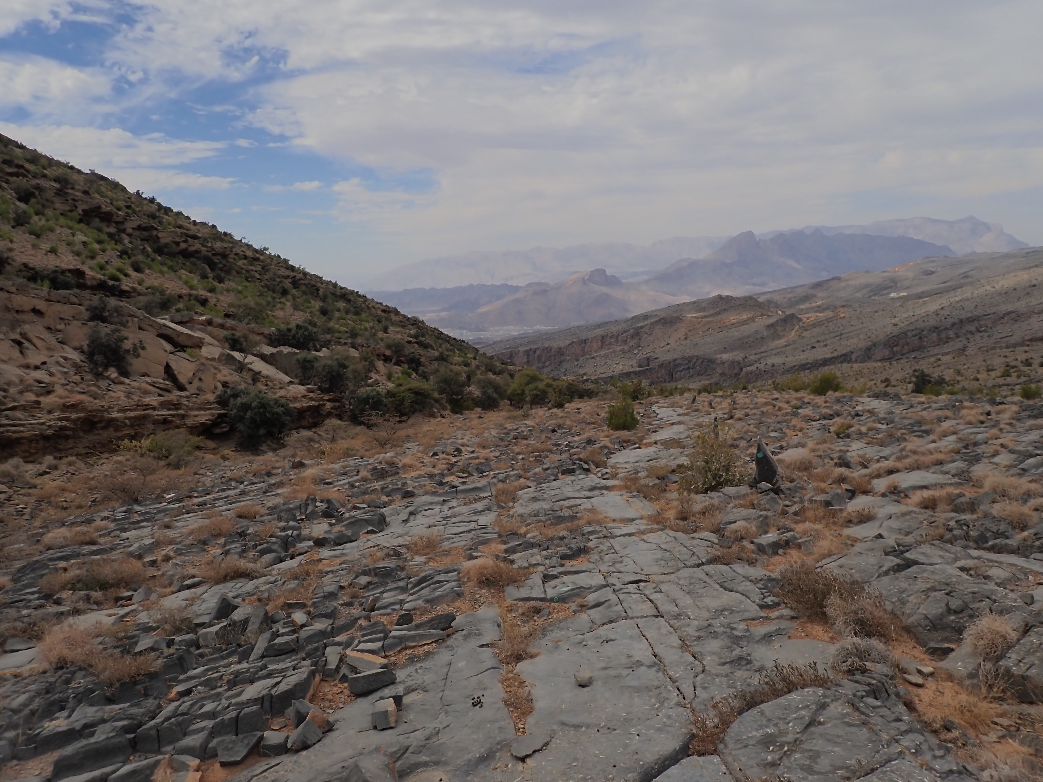 The Donkey track, looking south down the slope towards the town of Al Hamra and Misfah al Abriyyn.
The walk up to the ridge was not too birdy. There were the usual Black redstarts, and near the top of the ridge a lone Egyptian vulture Neophron percnopterus. There was excitement however when I spotted two massive dark birds, soaring distantly above the ridge. These could only be Lappet-faced Vulture Torgos tracheliotos, and raising my binoculars I was happy to confirm the ID.
Here Frederic picked out a campsite with an excellent view, and conveniently close to a small Pashtun Juniper, which I hoped would host some interesting moths. After collecting some stagnant water from a nearby concrete reservoir, and filtering it and nuking any microbes with chlorine tablets, we hung up the LepiLED on the juniper. Due to the colder temperature, the catch was poorer than that at Misfah. However, there was some serious quality amongst the catch, my favourite being this black and white gelechiid. This has now been identified by Arno Beidts as Agnippe separatella. Tantalisingly, I also saw what I thought was an Argyresthia — a genus of moths that feeds in Junipers in europe — despite no Argyresthia being known from Oman (to my knowledge). Sadly I fumbled it, and it escaped my pot. One for a future trip!
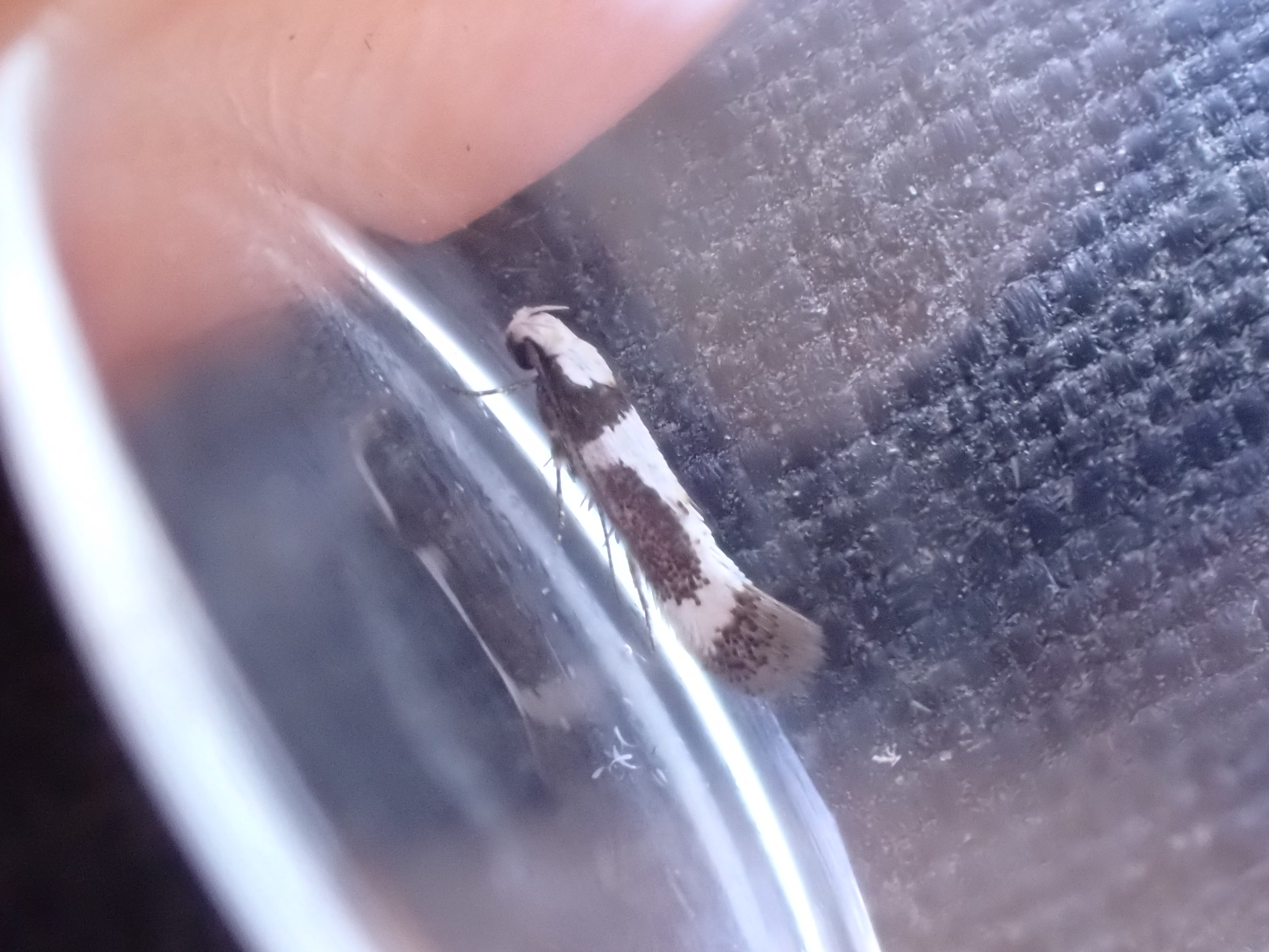 Agnippe separatella, with thanks to Arno Beidts for the identification.
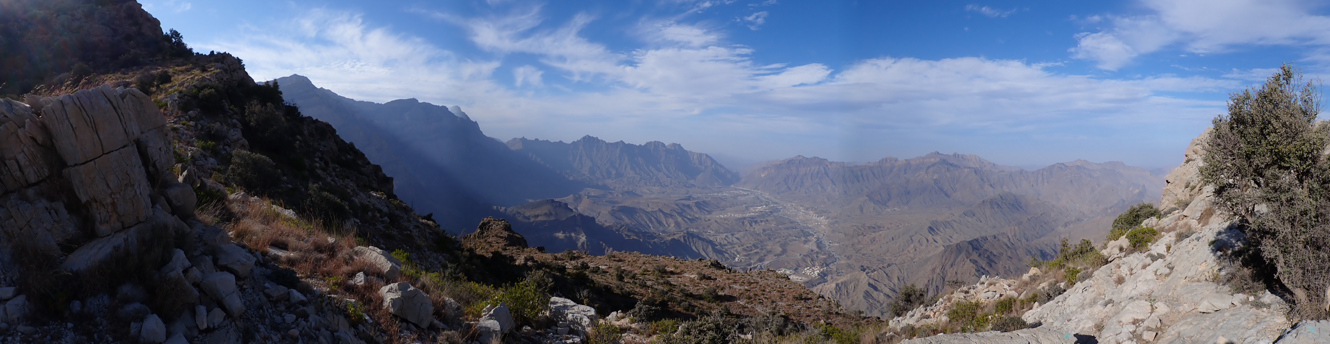 View from our campsite on the ridge, looking north-west.
The following morning we had an epic view for our morning ablutions. Here we had a gentle-ish day planned climbing along the ridge towards Jebel Shams, following the well-marked ultramarathon route. The route dipped down the northern, seaward side of the ridge, taking us into a pleasingly verdant scrub-forest dominated by Pashtun juniper. Overhead another Bonelli’s Eagle patrolled the ridge, and White-spectacled Bulbuls flitted amongst the trees, calling. It was here that we met another hiker, an Omani woman from Muscat who was hiking alone, and spoke fluent English. She was first hiker I’d come across in the Hajar, and as it turns out, she was the only one we would meet. It was from her that we realised we’d taken a wrong turn and needed to double back to find the turn onto the ridge. Other than this, the day’s walk was largely uneventful, with plenty of time spent admiring the junipers.
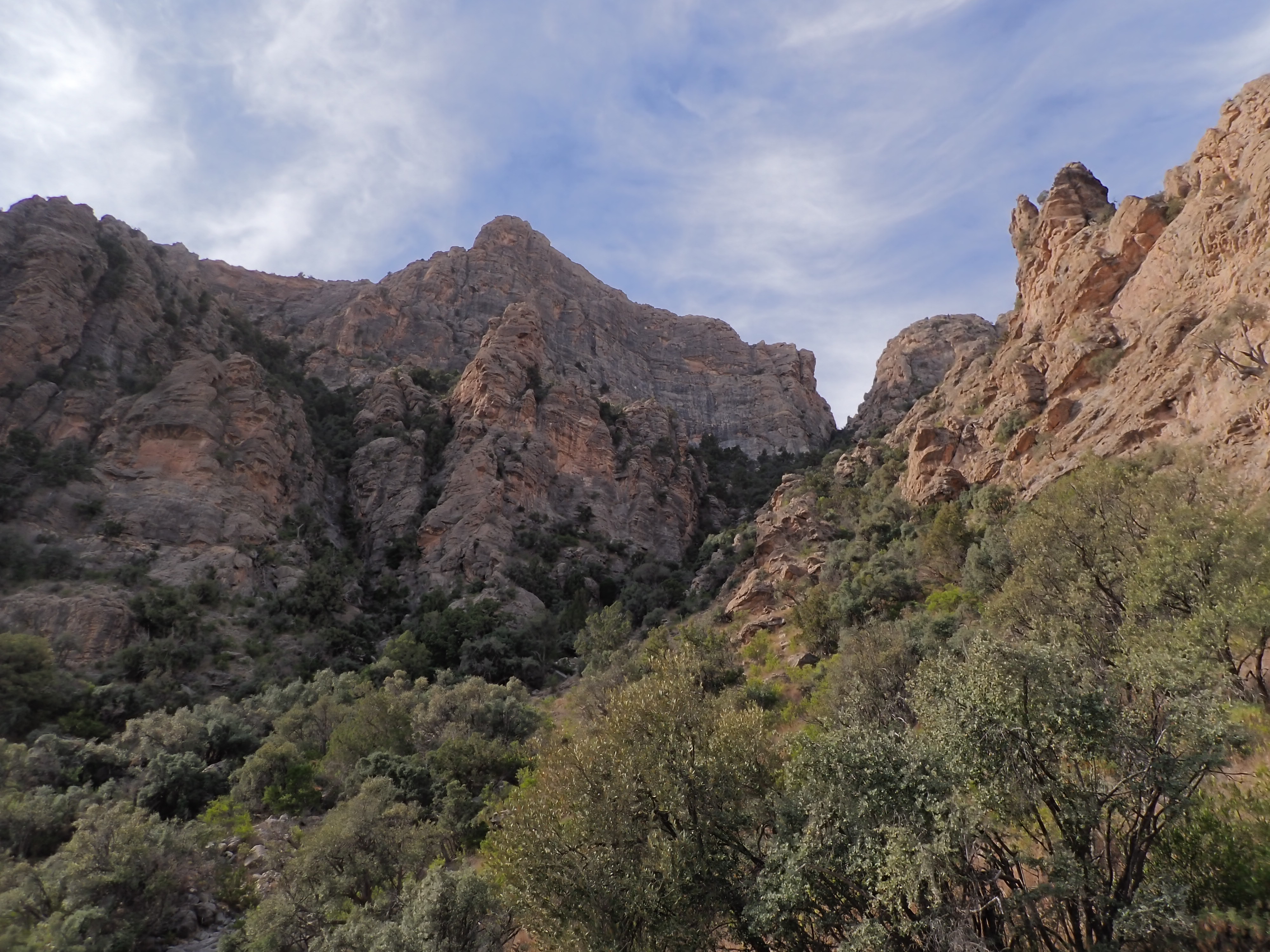 The short woodland of the Hajar.
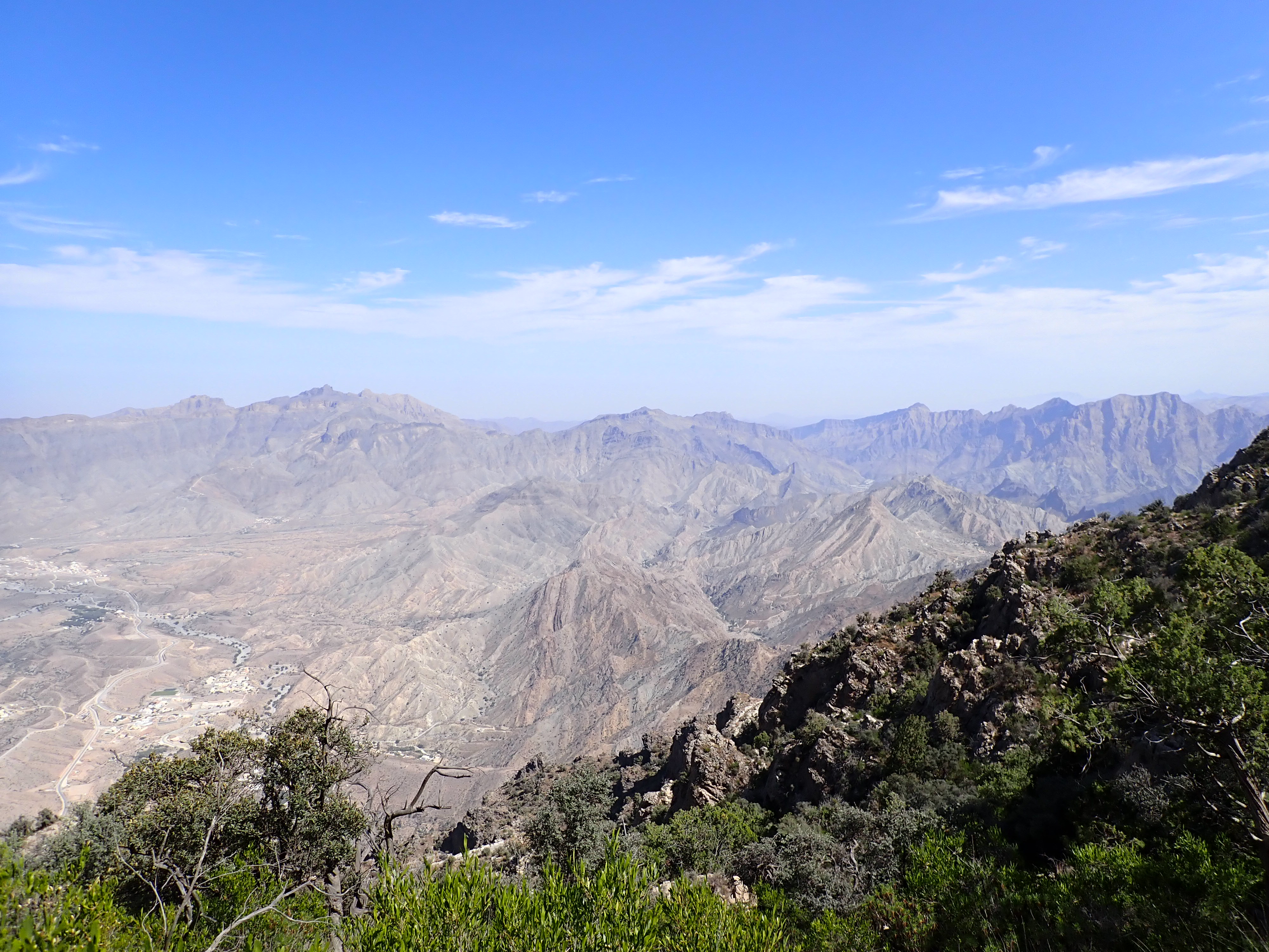 View looking ENE, down the seaward side of the ridge.
A couple of hours before sunset we arrived at our campsite, just below a moderately steep final scramble that leads up the ridge to the summit of Jebel Shams. Here, there are a series of drystone corrals which provide shelter from the wind. Frederic and I each chose our own corral to make camp in, and immediately set out in search of water.
The water source for this camp is quite a memorable one, being about 100m along a narrow limestone cave (Sab Al Nar cave) in the cliff face of Jebel Shams. To reach it from the camp site, one scrambles down the ridge and west, following quite a well-worn path.
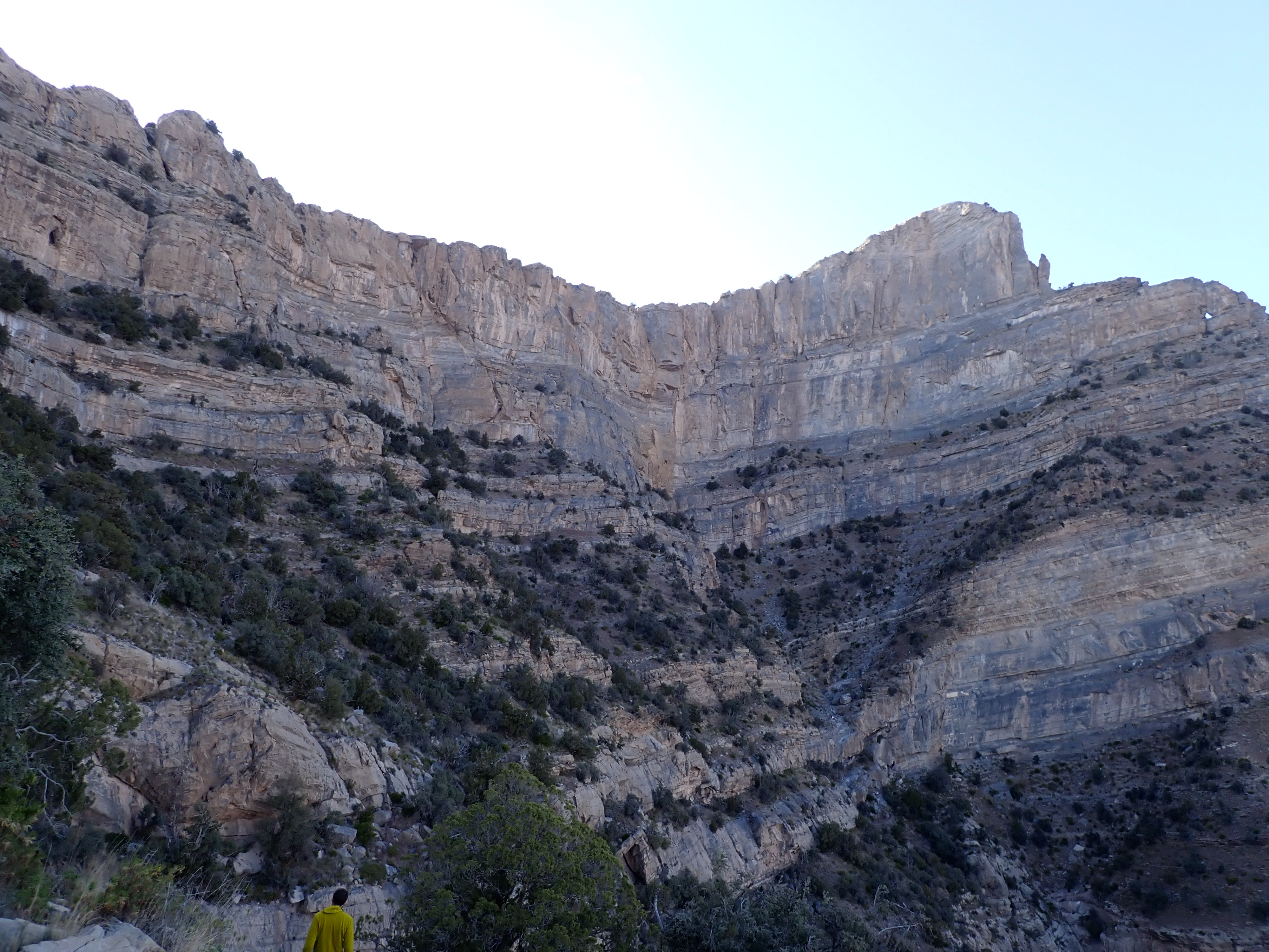 Descending the ridge towards the cave spring.
The cave has quite a broad and spacious entrance. However upon proceeding deeper one climbs up a slope at the back of entrance, where the cave narrows suddenly. Here the air rapidly becomes thick and humid as one climbs the slope. From here the way is obvious, following a narrow but not uncomfortable passage (average width of ~1m) deeper into the rock. When close to the cave pool, the cave forks in two, though both passages lead to the pool. In any case, there was a steady stream of plastic litter and other evidence of human activity for us to follow.
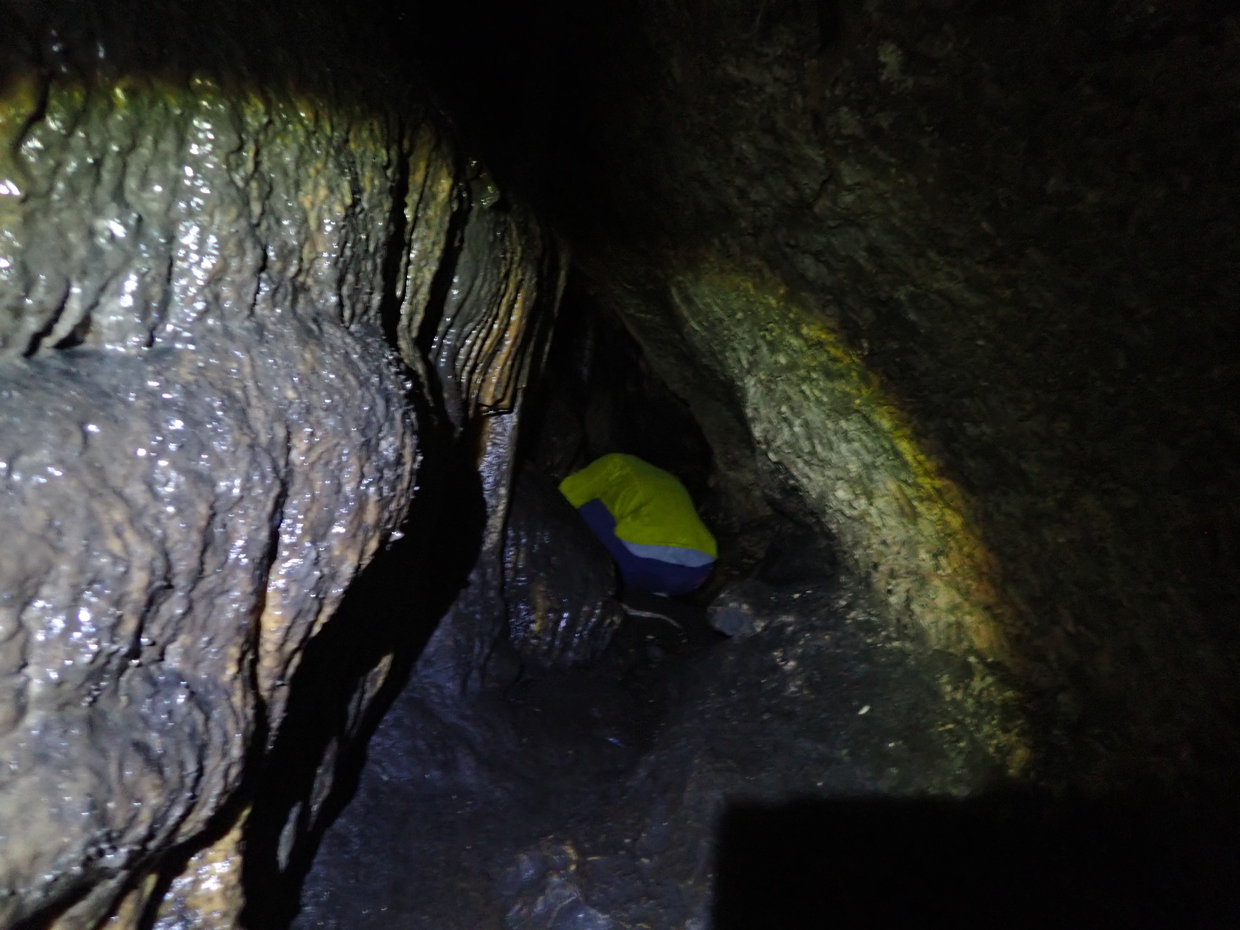 Sab Al Nar cave, near the pool junction.
 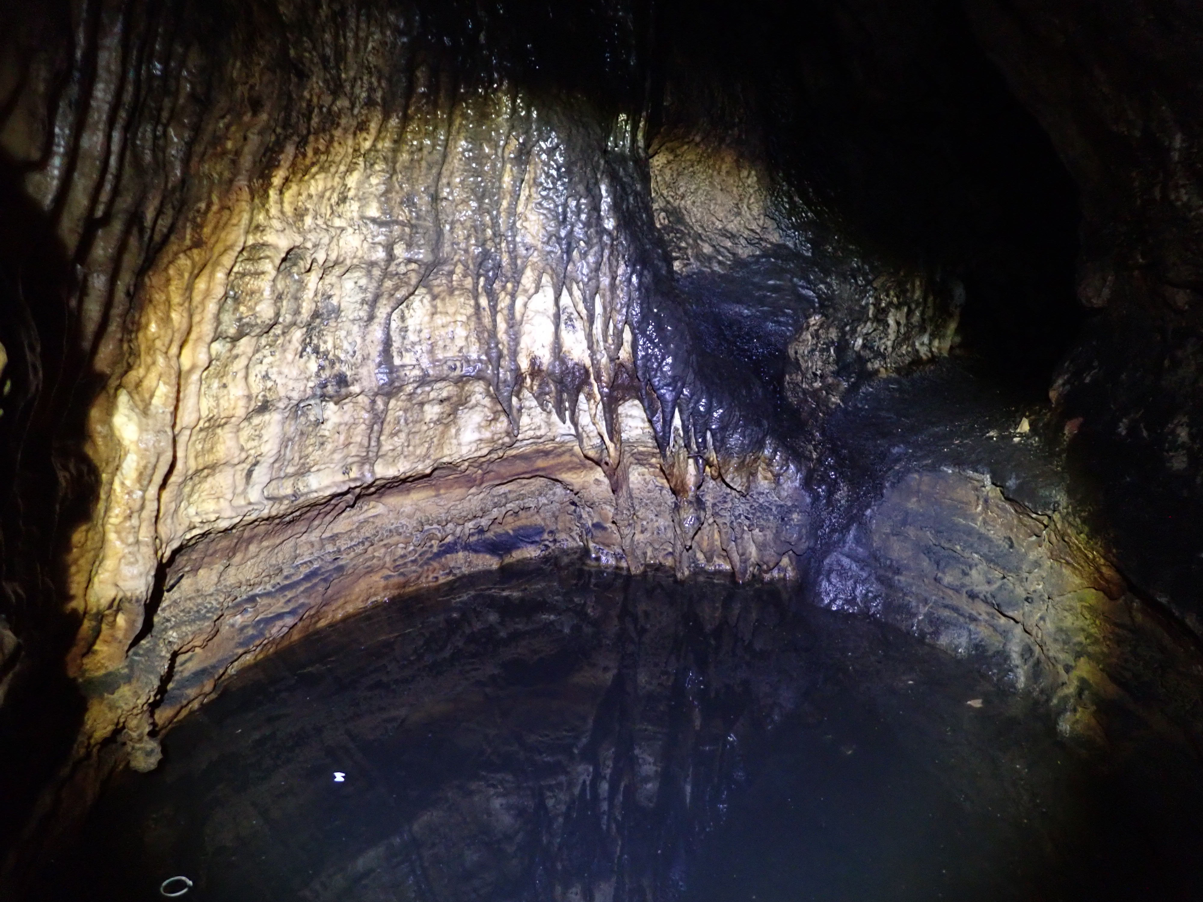 The pool in Sab Al Nar cave. Delicious!
Upon arrival at the pool we each took turns filling our water bottles, using the junction to switch places as there is only really room for one person at the pool. Having successfully not disturbed any of the fine silt settled at the bottom of the pool, we were treated to beautifully clear water, which we would later find (after filtering and treatment) has a distinct popcorn or almost eggy flavour. I presume some sulfur compound in the water?
That night we took advantage of our sheltered corrals for some mothing. Using a large pale rock to identify attracted moths, I hung the LepiLED from my corral wall and waited to see what would come to visit. We didn’t have long to wait, and almost instantly moths began to arrive. Here we had our familiar friend Chiasmia latimarginaria, the handsome middle eastern gelechiid Deltophora fasciella, and a quite striking geometrid that I’m still yet to identify. After a couple of hours with the light we called it quits and went to bed. As I was wriggling into my bivvy bag, and Pallid scops owl began singing in the trees nearby.
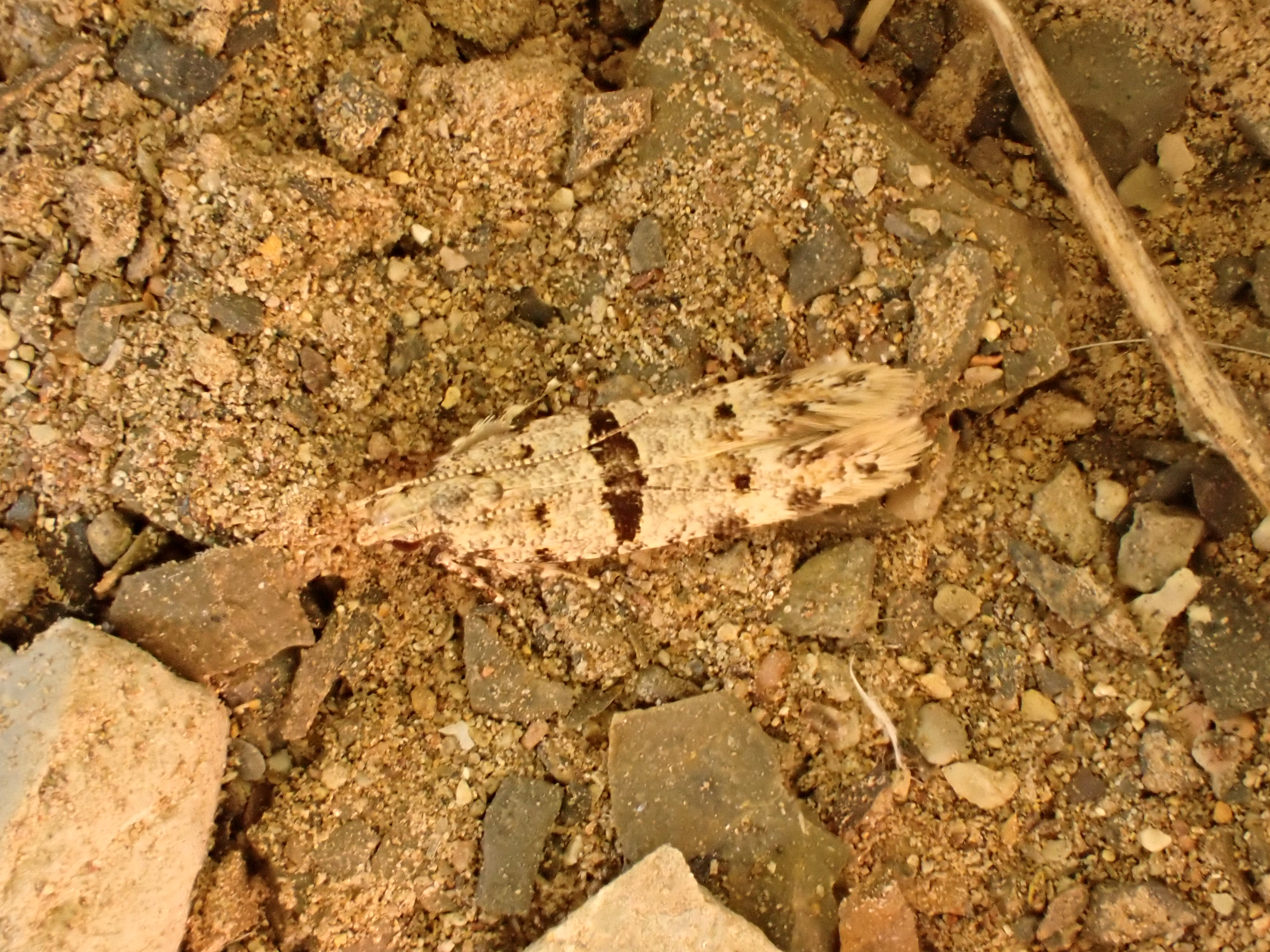 Deltophora fasciella.
 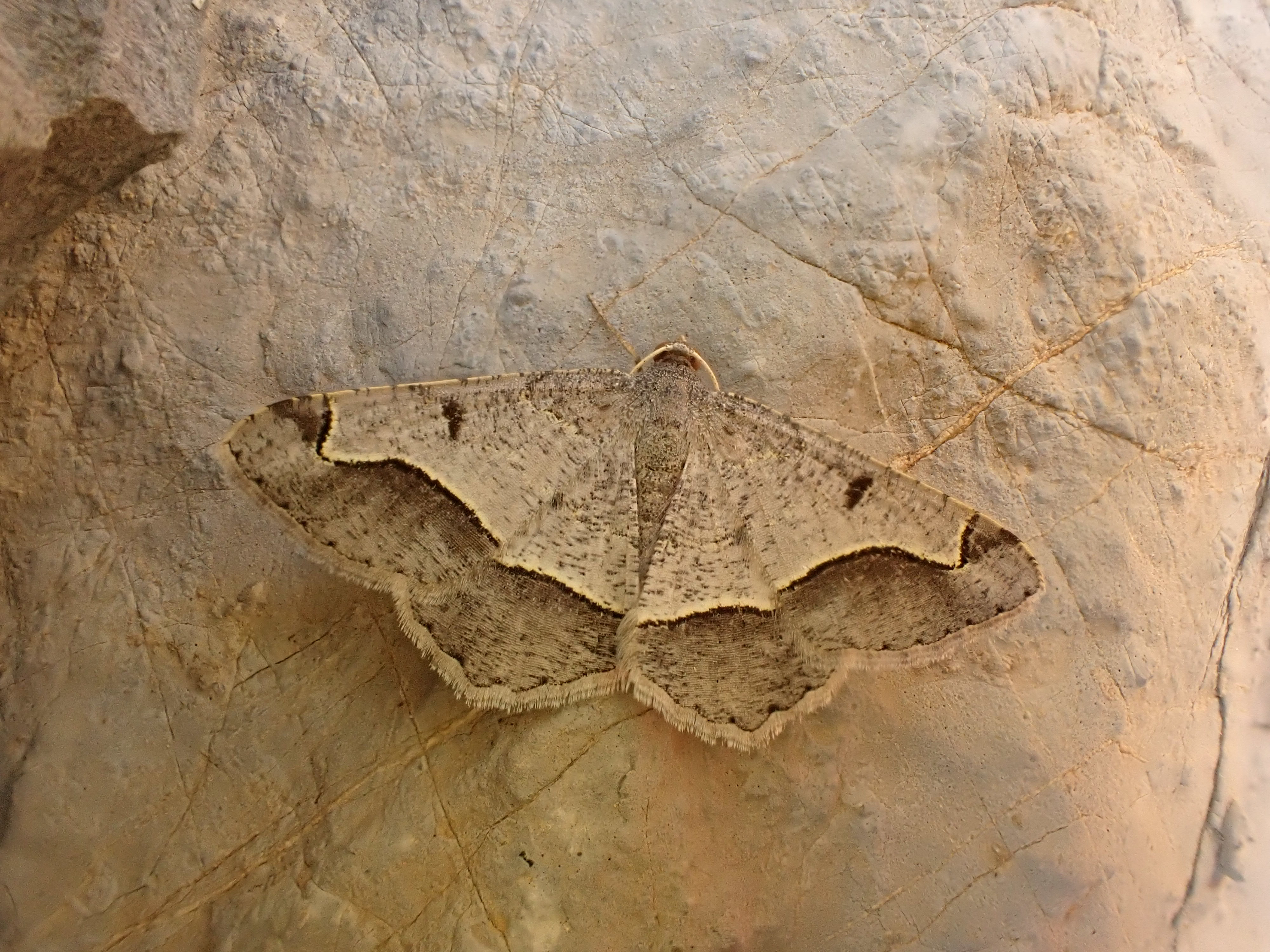 Geometridae sp.
The following day our plan was to walk back downhill to Misfah al Abriyyn via a route that John billed as a donkey track, passable in only a few hours. The path began smoothly, and as we made our way down the largely flat sheet of rock that comprises the southward Hajar, we reached a small hut at the head of a green wadi. John’s path follows this wadi, which connects to another larger valley, eventually leading back to Misfah. Upon descending down into the wadi our progress quickly deteriorated, and we were back to the slow, boulder-hopping wadi travel that we’d become accustomed to.
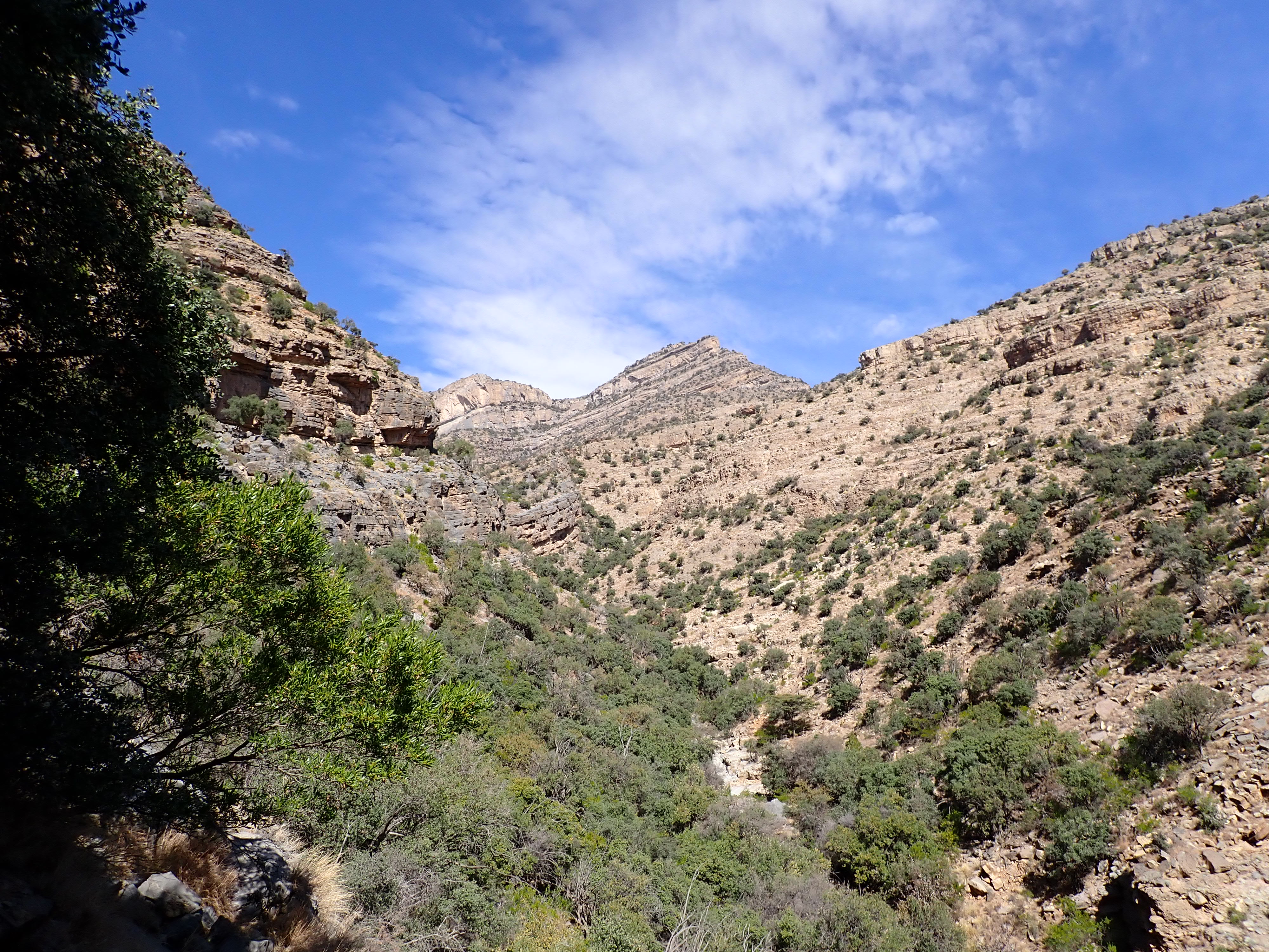 The green wadi, looking back up to Jebel Shams. Note the boulders in the wadi bed which make wadi travel so slow.
At a certain point the boulders become too large to be passable, and the route scrambles back up the cliff on the right bank of the wadi, where one proceeds via a long route of ledges. This route was absolutely spectacular and an extremely memorable walk. The route is quite exposed, with a bit of a drop to your side, and there are several points where this ledge is overun by a slope of fine scree, that requires care to traverse.
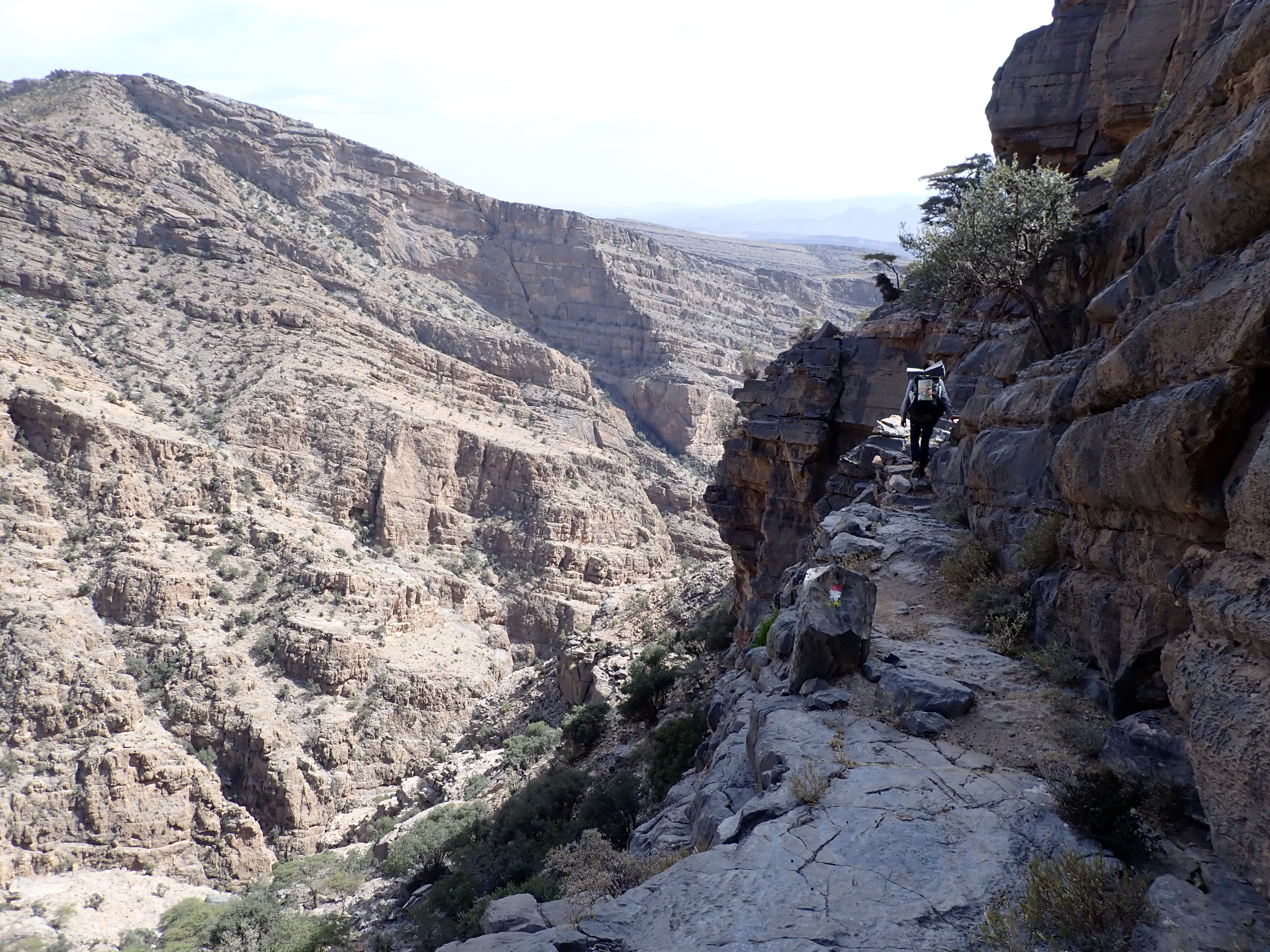 The cliff ledge route. Note the man-made drystone ‘bridge’ that Frederic is crossing.
About midway along this route there is a water source, where a plastic barrel is positioned underneath a cliff drip. The water is clear and good to drink, but care needs to be taken when filling a bottle not to collect all the drowned invertebrates floating on the surface. Upon inspecting this debris, I saw three small moths floating dead in the water. They looked tantalisingly like Argyresthia, but I suspect they are actually Zelleria. I’ve attached a picture of one below, please let me know if you know the species.
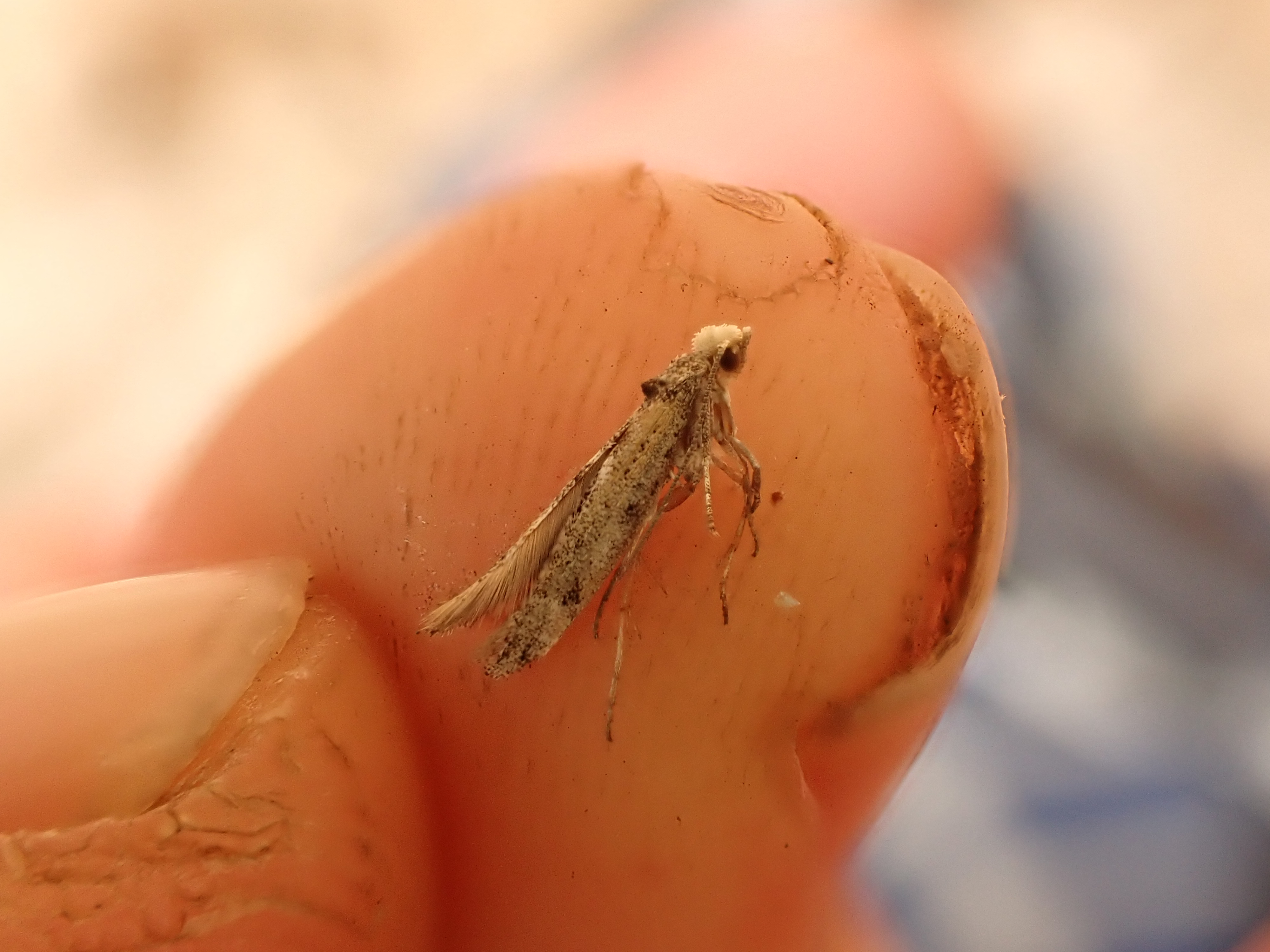 Zelleria sp.?
The wadi was full of goats and it wasn’t long til we met their owner, a man who sat motionless on a ledge above the path with a rifle at his side. We respectively attempted to exchange pleasantries in arabic and english, though I’m not sure how successful either party was. By coincidence though, he was leaving his post with us, his brother having just arrived to relieve him of his watch. Wearing only light leather sandals, he soon raced ahead of us and we only caught up to him again near the end of the ridge walk, where the path ascends a scree slope of loose shale, back onto the flat and open limestone pavement of the Hajar.
By now, it was maybe three hours before sunset. We had departed our camp not long after dawn, so we were a bit surprised at John’s predicted pace for the route. We weren’t even in Misfah yet! However we could see a village immediately in front of us, with a road leading away downhill from it. As we entered the village we were welcomed into the village common room (the Majlis) by one of the villagers, and we were all too glad to sit down in the cool, dark room. Here we were treated to deliciously sticky, toffee-like dates (I think probably the ‘khalas’ variety?), and hot, restorative omani cardamom coffee. We didn’t have much to offer in return besides some trail mix, which unfortunately did not appear a hit with the village’s menfolk, who joined us in the Majlis. Feeling restored, we tried our best to ask if we could refill our water bottles at the tap outside. Our host was only too happy to oblige, and offered us a lift back to Misfah. This offer we graciously declined, and trying to say ‘shukran’ in as heartfelt a manner as we could, we plodded away down the vehicle track.
After some cross-country walking, we entered Misfah via a route clearly not often taken by tourists (through an old chicken wire fence, down into the small gully full of litter, up past the barking dog into the car park). Here we met up again with Lukas, who’d had some solo adventures around Nizwa that he was keen to share with us. Now quite familiar with the village, we walked along the Aflaj to its source, where we made camp for a second time.
Here I put out the LepiLED on our favoured rock. The day seemed warmer than before, and moth numbers were higher. The stand-out moth was the arctiid Creatonotos omanirana, being a member of quite an iconic genus with some very impressive pheromone-releasing structures in the male. A striking Acantholipes circumdata was also welcome.

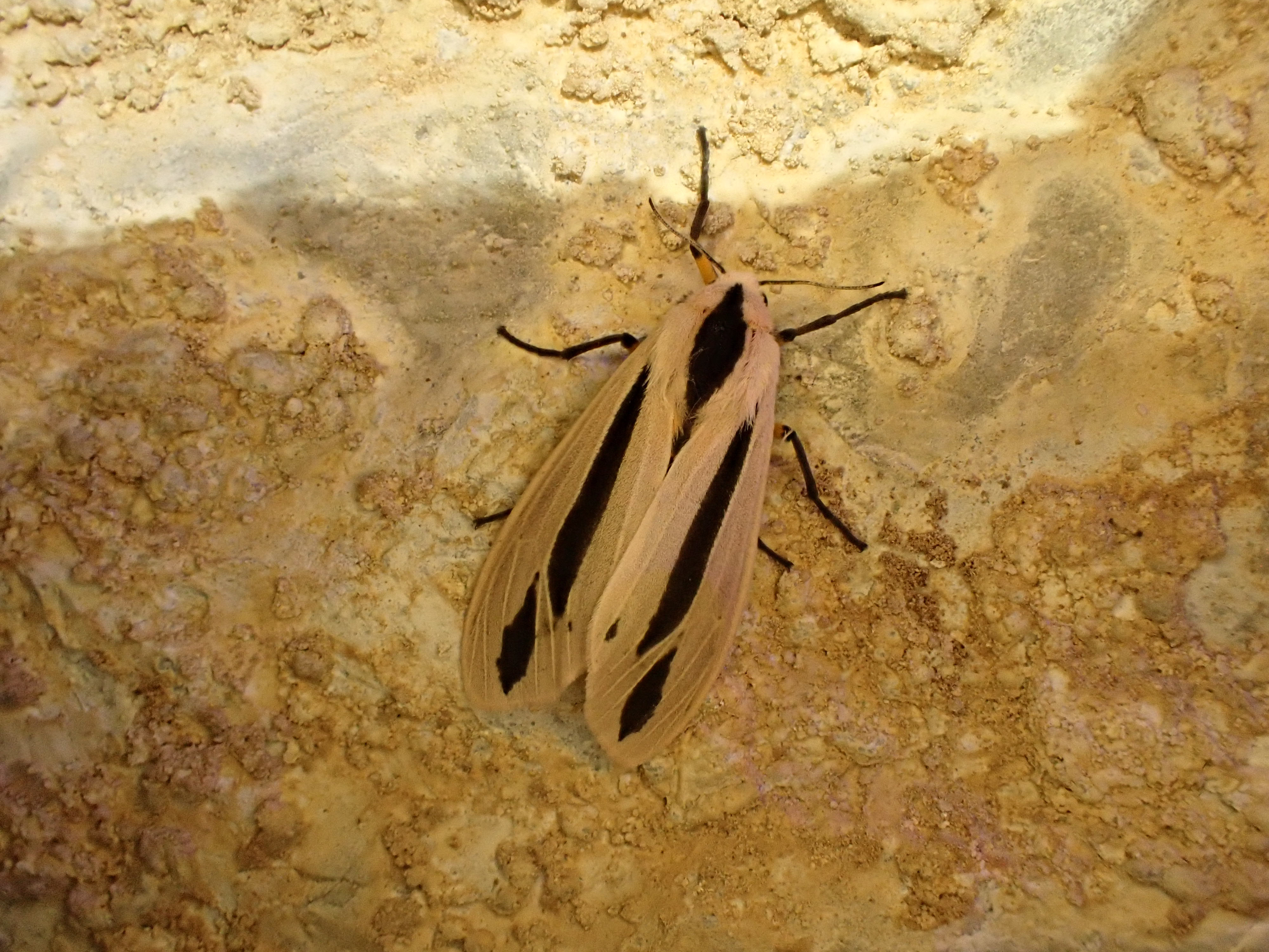 Creatonotos omanirana.
 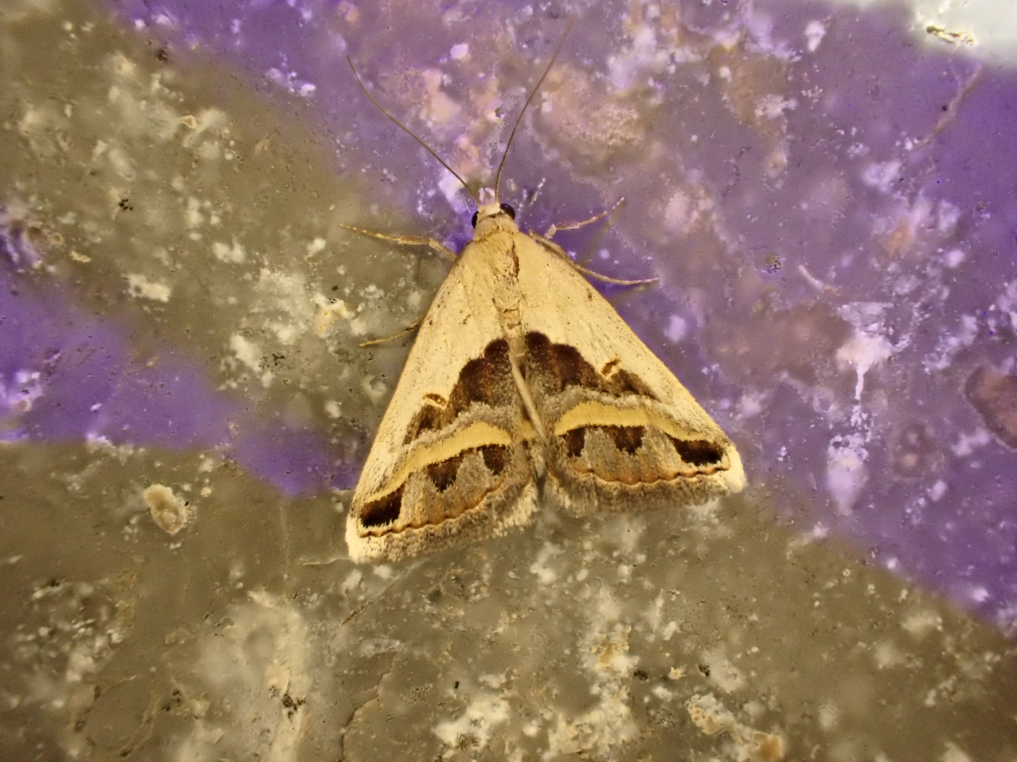 Acantholipes circumdata.
Days 13-15 - Back to Muscat
The trip was now coming to an end and we had to make our way back to Muscat. Unfortunately, the Hajar lay in our way! After a morning’s touristing visiting the UNESCO World Heritage fort in Bahla, we sought to find a taxi willing to take us around Jebel Shams, from where we would re-join John’s original route leading down through a wadi to the village of Yiqa Al Jadeed, on the highway to Muscat.
To our amazement, we found a driver willing to take us. Initially doubtful of the suitability of his Toyota corolla for the mountain road, we were reassured when he drove us to his home, and told us to home over into his landcruiser. He then went inside the house, and came back with a couple kgs of dates (again khalas I think - lovely) and a flask full of cardamom coffee. We had a comfortable drive up to the head of wadi, though I think our driver was a bit stressed by the mountain road and eager to get the job over with.
With again not long til nightfall, we descended down a steep boulderfield to the base of the wadi. Above us stretched some enormous cliffs, which look likely to harbour Omani owls. At the head of the wadi there is a large pool, from which an aflaj drains, feeding to small agricultural terraces slightly further down the wadi. Remarkably, there are fish in this pool, and some sort of caddis fly larva. I’d love to know what these fish are; if I had to guess they were something like Garra barreimiae (looking like some sort of loach), but I’m sure they have very interesting biology.
That night (after finishing most of the dates), we set up the LepiLED for the final time. We chose again a flat rock, hanging the lamp out in front of it from a tree branch. Leaving the trap to do its thing, Frederic and I walked down the aflaj into the dark wadi to listen for owls. I tried imitating the Omani owl call several times, and played a few recordings of Omani owl song from my phone. On two occasions both Frederic and I thought we heard something answer us, but it was too distant to be sure.
Happily the LepiLED had brought in the goods, and we returned to a nice mix of moths. The most interesting for me were the lymantriid Ocnerogyia layla (thanks to user lymantriman on iNaturalist for ID), and a small white micro, which looks like a Scythris, possibly pollicella, though I’m not entirely sure. Feeling quite tired we packed the trap up after maybe only an hour or so, and lay back on our camp mats. This deep in the wadi, without moonlight, the wadi walls around us looked totally black, and obscured almost all of our vision of the outside world. Looking up, the small visible sector of the starry night sky looked like a reflection in water.
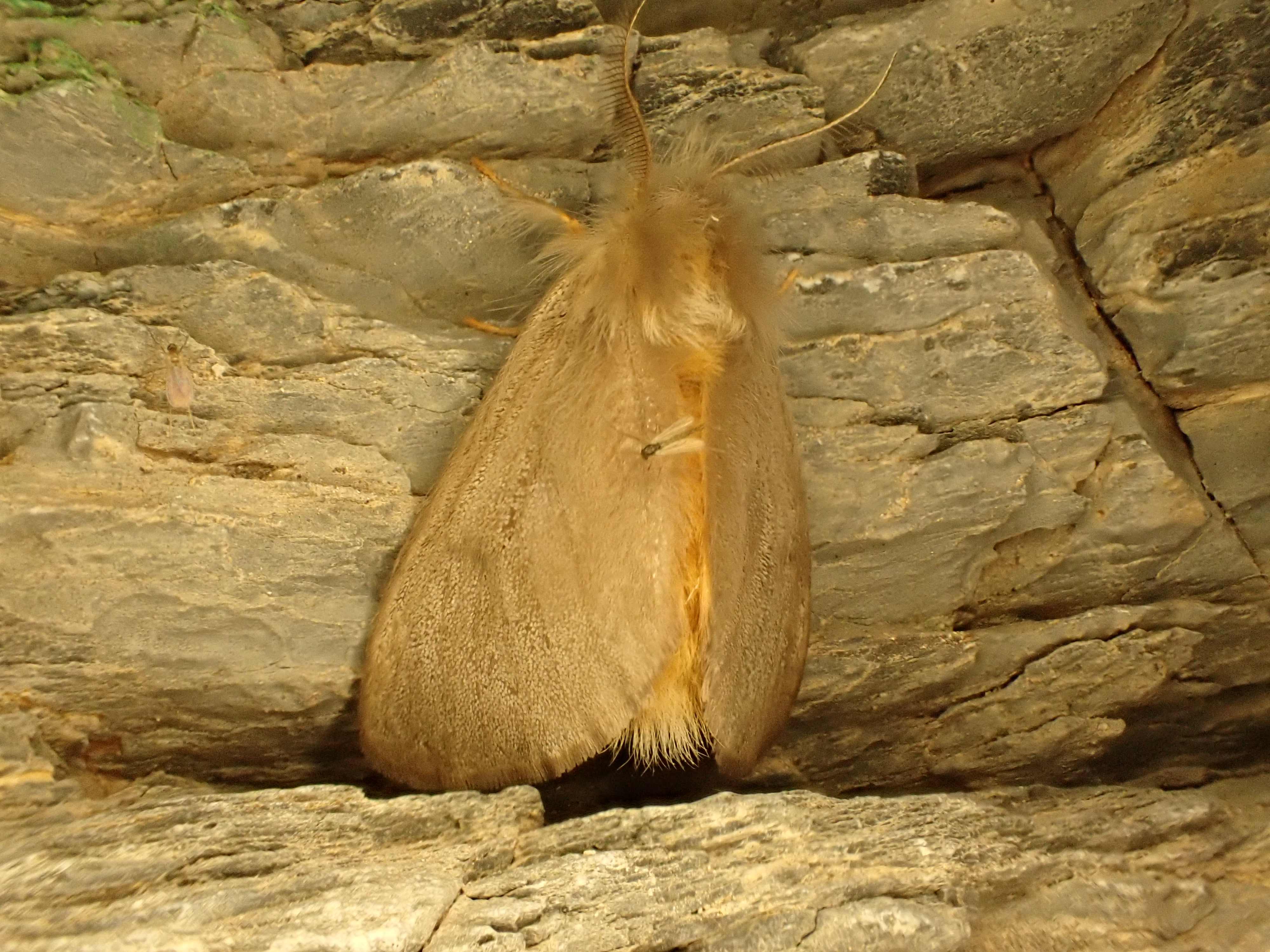 Ocnerogyia layla. Thanks to user lymantriman on iNaturalist for ID.
 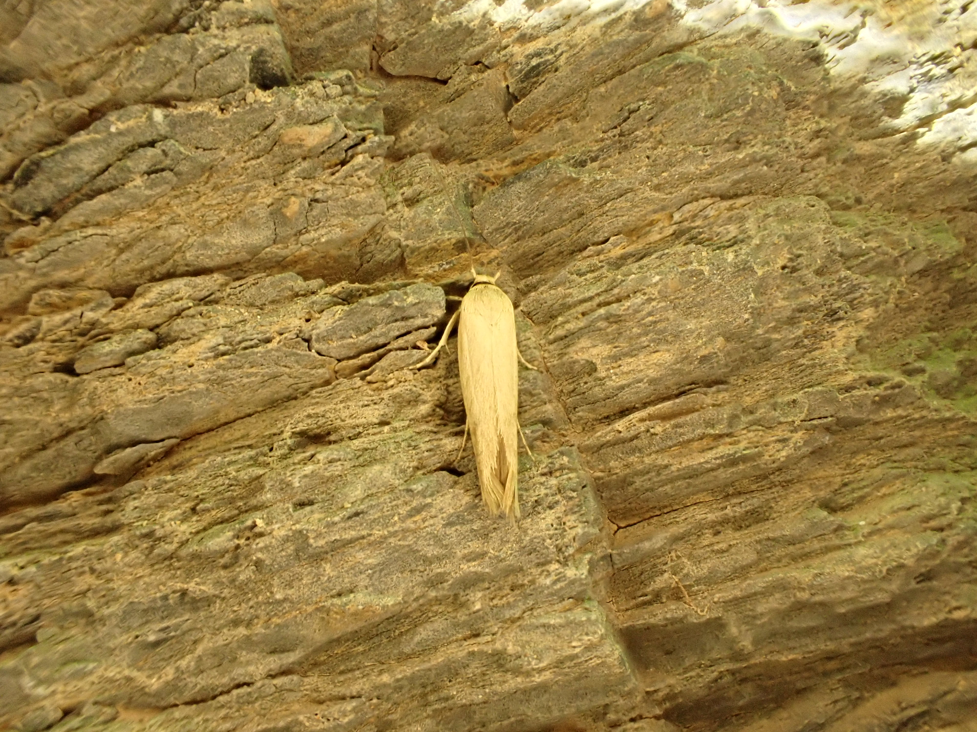 Scythris pollicella?.
The following morning
As the sun rose it was cool in the wadi. The plan for today was to follow the donkey track that joins the small farm in this wadi to Yiqa. After a quick breakfast we struggled to identify the trailhead based on John’s GPS track, possibly confounded by GPS signal deep in the wadi. Frederic noted a point on the slope where a donkey had descended the evening before, but there was no obvious path visible and we decided to split up in search of the trail. With hindsight this was a pretty stupid thing to do, as I wasted an hour of our time scaling the sides of the wadi, and it turned out that Frederic’s initial guess was correct. It was about 10am by the time we actually set out on our way down to Yiqa, now on an obvious track along a cliff ledge, covered in donkey dung. This experience was fairly typical of our walking experience in the Hajar. If man and beast are constrained in their choice of route (e.g. they have to follow a specific cliff ledge), then the trail is well-worn and obvious. However, as the landscape broadens out, travellers are no longer constrained and can take any route they wish. As a consequence there are big open stretches of boulder field with no clear path and you need to know where you are going. In any case, a combination of John’s GPS track and regular piles of donkey dung kept us right, and by lunchtime we had left the wadi and were looking northward, downhill to Yiqa.
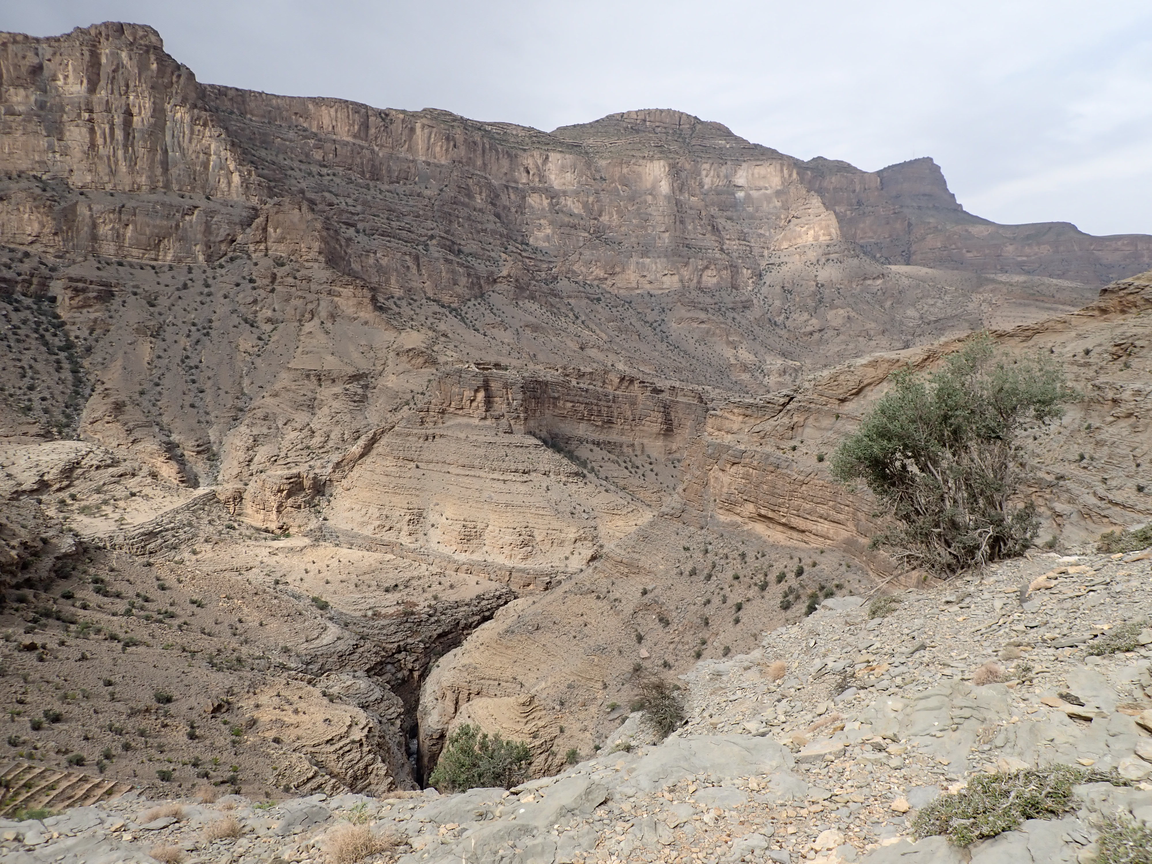 View looking west. Down below you can see the deep wadi gorge, and part of the terraces constructed here for farming.
The route was both beautiful and intimidating. On many occasions we had to traverse fine scree slopes that terminate in a deep gorge at the base of the wadi. If you slipped and slid down the slope you might have quite a hard time getting out again. It was also devoid of any bird life. Indeed the only evidence of animal life for much of the day was a sandy-biege viper seen briefly by Frederic and Lukas (I only saw the tail of it as it slid into a burrow). No idea of the species, though the Persian Horned Viper Pseudocerastes persicus looks a decent visual match.
With Yiqa now in our sights (though still distant), we began plodding steadily downhill. Part of the way down we came to evidence of human settlement, namely a full water reservoir. Ten minutes later we found the owner, a chap sat outside his house, watching his chickens peck at the gravel. After failing to
Summary
List of birds seen in the Hajar Mountains, Feb 2025
Grey Francolin Ortygornis pondicerianus
Sand Partridge Ammoperdix heyi
Rock Dove Columba livia
Collared Dove Streptopelia decaocto
Laughing Dove Spilopelia senegalensis
Pallid Swift Apus pallidus
Lappet-faced Vulture Torgos tracheliotos
Egyptian Vulture Neophron percnopterus
Bonelli’s Eagle Aquila fasciata
Pallid Scops Owl Otus brucei
Little Owl Athene noctua
Arabian Green Bee-eater Merops cyanophrys
Indian Roller Coracias benghalensis
Common Kestrel Falco tinnunculus
Brown-necked Raven Corvus ruficollis
Desert Lark Ammomanes deserti
Delicate Prinia Prinia lepida
Pale Crag Martin Ptyonoprogne obsoleta
White-eared Bulbul Pycnonotus leucotis
White-spectacled Bulbul Pycnonotus xanthopygos
Common Chiffchaff Phylloscopus collybita
Scrub Warbler Scotocerca inquieta
Lesser Whitethroat Curruca curruca
Menetries’s Warbler Curruca mystacea
Black Redstart Phoenicurus ochruros
Blue Rock Thrush Monticola solitarius
Pied Wheatear Oenanthe pleschanka
Hume’s Wheatear Oenanthe albonigra
Purple Sunbird Cinnyris asiaticus
Indian Silverbill Euodice malabarica
House Sparrow Passer domesticus
Grey Wagtail Motacilla cinerea
Long-billed Pipit Anthus similis
Striolated Bunting Emberiza striolata
List of moths identified from the Hajar Mountains, Feb 2025
With credit to Arno Beidts and others on iNaturalist for their help.
List up-to-date as of 15/01/2026. As more species are identified, or identifications change, this list will change.
Psychidae
Amicta quadrangularis
Gelechiidae
Tuta absoluta
Ochrodia subdiminutella
Deltophora fasciella
Agnippe separatella
Pyralidae
Epicrocis pseudodiscomaculella
Etiella zinckenella
Aphomia sabella
Crambidae
Noorda blitealis
Geometridae
Neromia pulvereisparsa
Conolophia conscitaria
Chiasmia latimarginaria
Noctuidae
Pandesma robusta
Heliothis nubigera
Caradrina atriluna
Thysanoplusia exquisita
Pseudozarba mesozona
Epharmottomena leucodonta
Erebidae
Antarchaea erubescens
Creatonotos omanirana
Casama innotata
Acantholipes circumdata
Tytroca dispar
Eublemma alexi
Ocnerogyia layla
Unidentified moths from the Hajar Mountains, Feb 2025
If you want to help out identifying these, please contribute to the observations on iNaturalist.
Zelleria sp.? iNat observation here.
(to follow)